Geographic Tools Final Test
star
star
star
star
star
Last updated almost 8 years ago
18 Nsɛmmisa
1
1
1
1
1
1
1
1
1
1
1
1
1
1
1
1
1
1
Latitude lines run...
Longitude lines run...
The 0 degree line of latitude is the ____________.
This line measures 0 degrees longitude.
A _______________ is exactly half of the Earth.
Which answer shows all the Intermediate Directions?
What is a map scale?
A scale model of the Earth is called...
Explains what the symbols on a map represent
One characteristic of a physical map is...
True or false: A political map will show the boundaries of each state/country.
The art of making maps is called...
Lines of latitude and longitude make up the....
Which map feature tells the subject of the map?
Describes the exact location of a place on earth
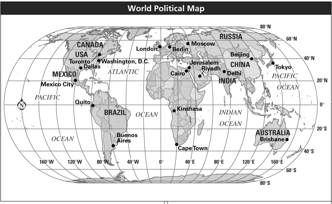
Which city is closest to the Equator?
What is the approximate location of Kinshasa?
Which city is located about the same longitude as Quinto?