1
Asemmisa {{asɛmmisaAhyɛnsode}}
2.
1
1
1
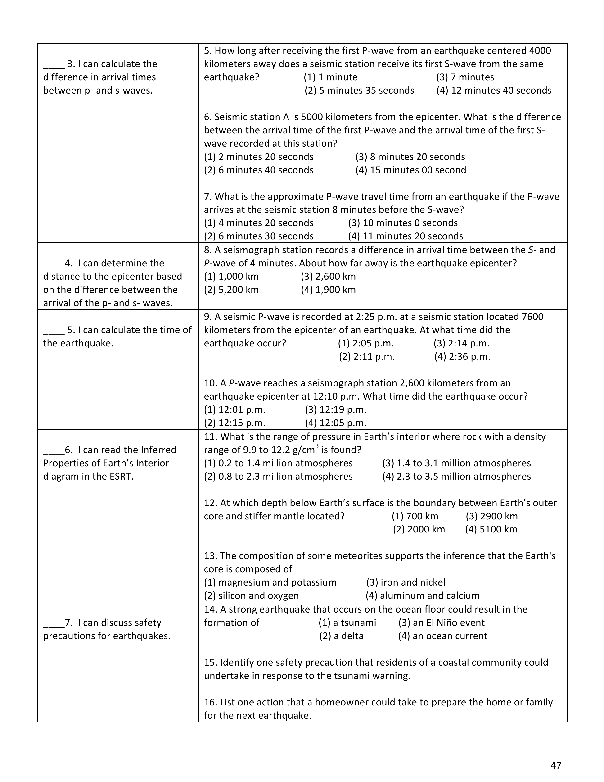
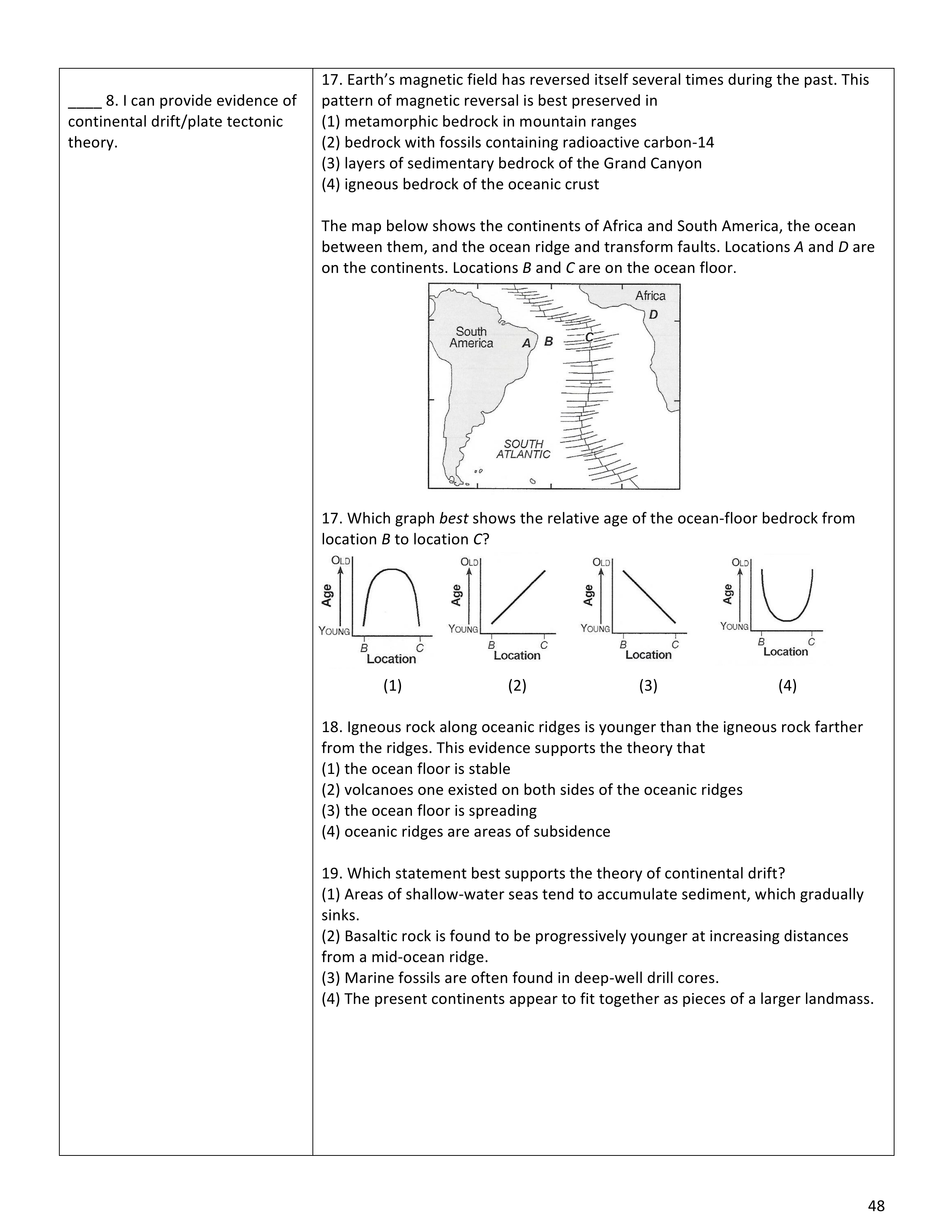
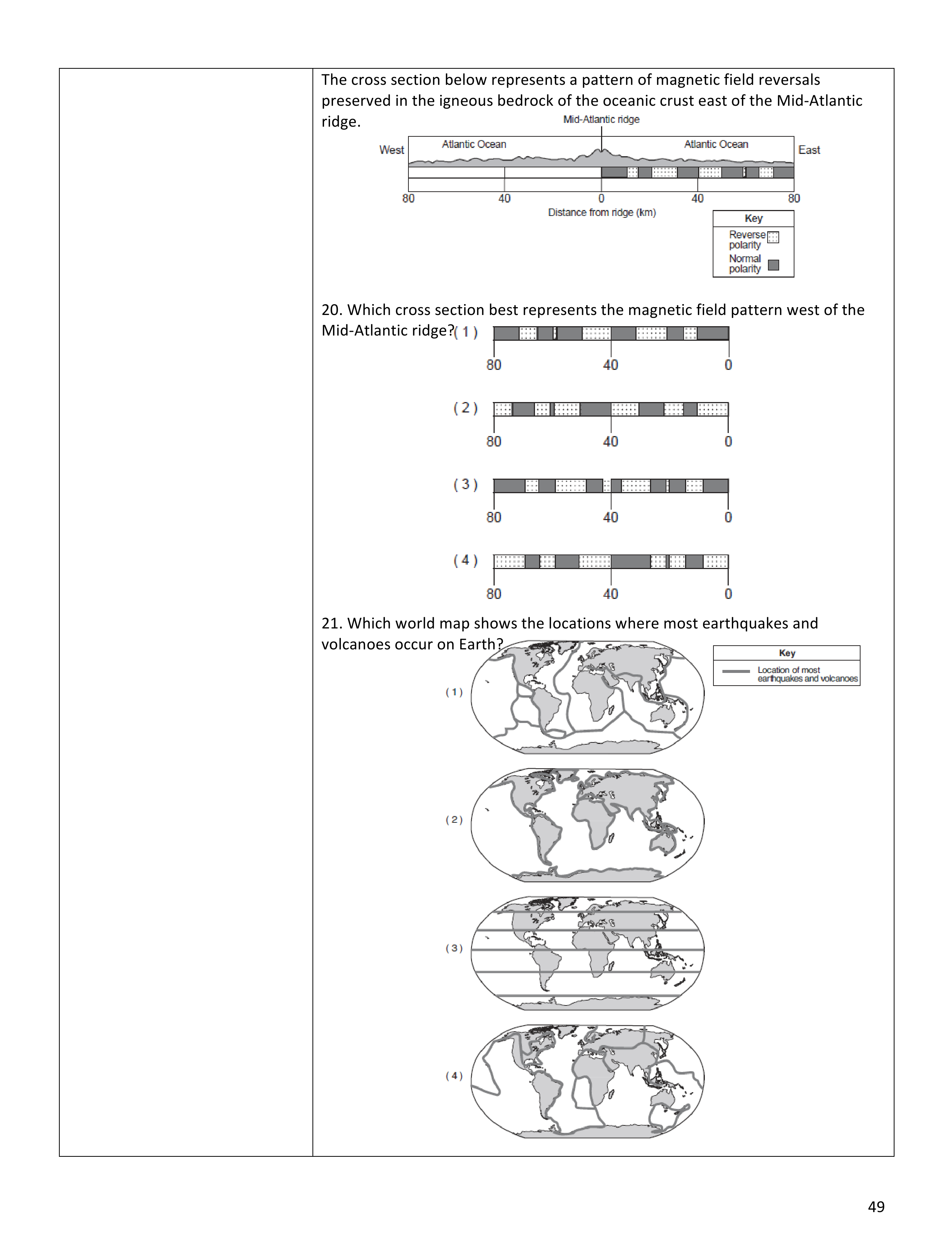
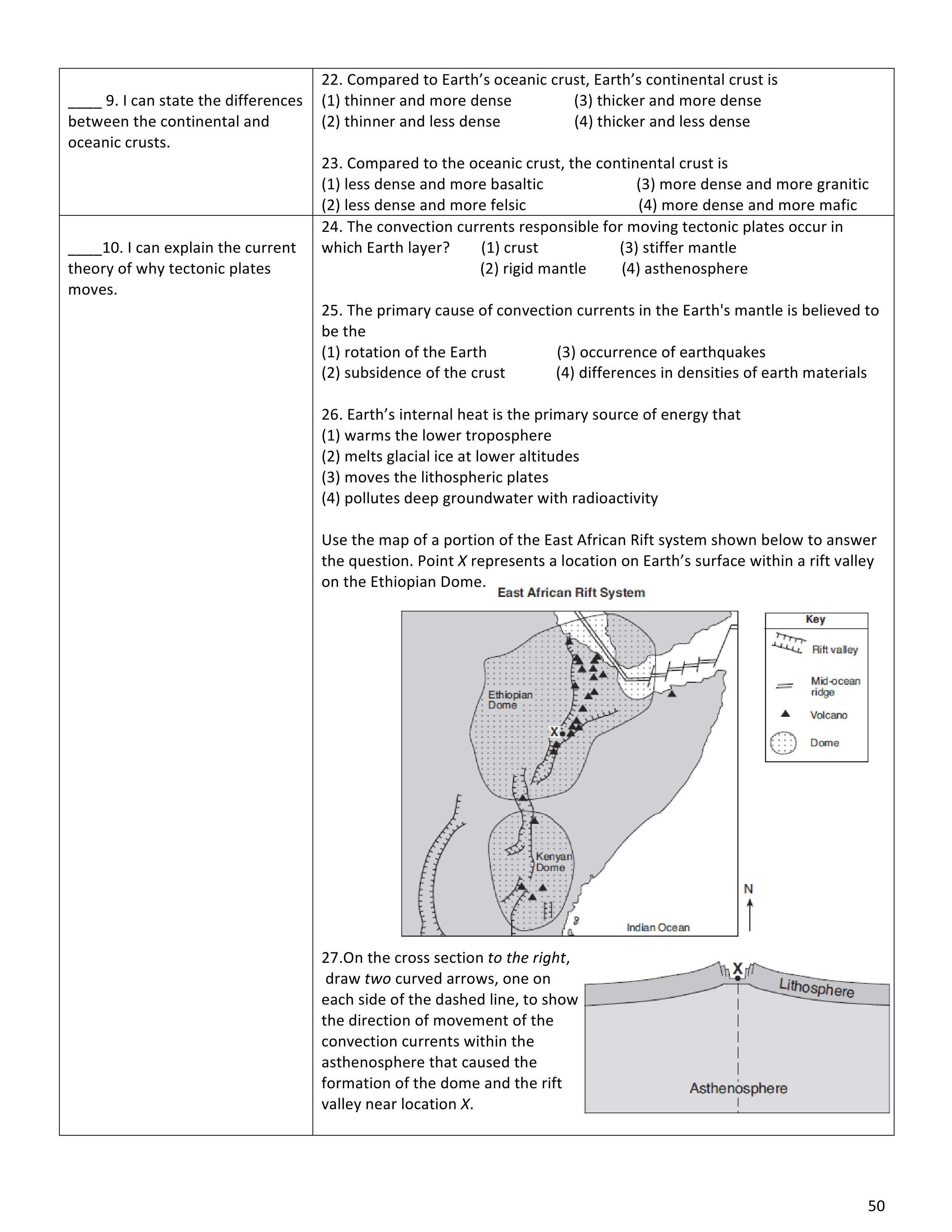
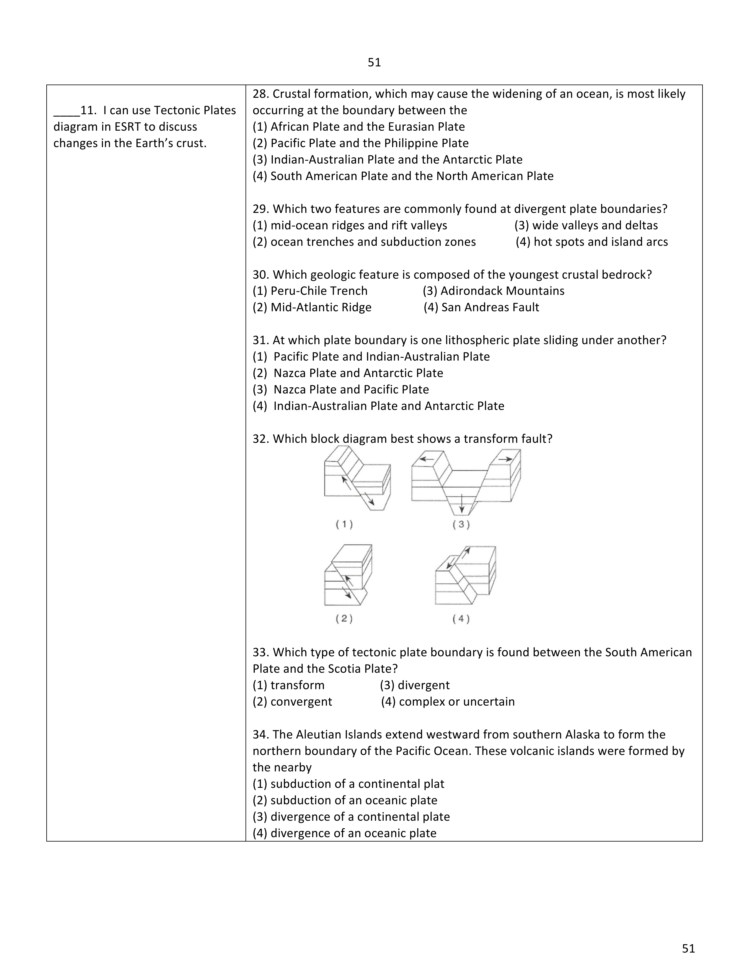
Hot spots are fascinating geological phenomena that generate magnificent island chains like the Hawaiian Islands. Stationary regions deep within the Earth's mantle, hot spots emit abnormally plumes of magma, causing volcanic activity as tectonic plates pass over them. The Hawaiian Islands exemplify this process, forming a hot spot track where each island represents a distinct stage in island formation. further shapes the islands, creating valleys and cliffs. This is generally why the older islands are . Through the hot spot track, we observe that the islands become progressively as we move northwestward. This knowledge, combined with other evidence such as magnetic anomalies, helps us determine the direction of plate movement.
P Waves:
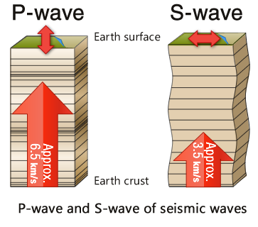
P waves, also known as waves or compressional waves. They are the seismic waves and travel through various materials, including , so they can pass through . Here's what you need to know about P waves:
Motion: P waves travel by (squeezing and stretching) the material they pass through. It's similar to when you push and pull a slinky toy—those motions create P waves.
2. S Waves:
S waves, also known as waves or shear waves, are like Earth's wigglers. These waves bring valuable information about Earth's interior, but there's a catch—they can only travel through solids. Here's what you should know about S waves:
Motion: Unlike P waves, S waves move by shaking particles or up and down, perpendicular to the direction of wave travel. Imagine shaking a rope up and down, and you'll get a sense of how S waves move.
Path through Earth: S waves can only pass through , such as rocks and the Earth's interior. They travel through liquids, including Earth's , which is iron and nickel. When S waves encounter a liquid, they stop, unable to wiggle through it.
Speed: S waves travel than P waves. They move at an average speed of about 3.5 kilometers (2.2 miles) per second. Due to their slower speed, S waves arrive at seismograph stations after P waves during an earthquake.
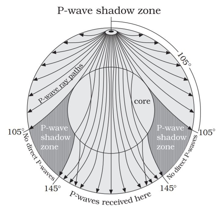
The Enigma of the Shadow Zone: As seismic waves propagate through Earth's interior, something fascinating occurs—the emergence of a shadow zone. This shadow zone holds crucial clues about the structure of our planet.
Definition: The shadow zone refers to an area on Earth's surface where certain seismic waves . It is a region of seismic silence.
P Wave Shadow Zone: Despite their ability to travel through all mediums, P waves experience a noticeable change in speed and direction when passing from one layer of Earth to another. This change in speed causes a bending or of the waves. As a result, a P wave shadow zone is created between 103 and 143 degrees from the epicenter of an earthquake.
S Wave Shadow Zone: S waves, which can only travel through solids, face a different fate. When encountering Earth's outer core, composed of molten iron and nickel, S waves cannot penetrate it. Consequently, an S wave shadow zone is formed beyond 103 degrees from the epicenter.
Continental Drift
The theory of continental drift, proposed by Alfred Wegener in the early 20th century, shattered the conventional wisdom that the Earth's continents were immobile. According to this concept, the continents were once joined together in a supercontinent called and gradually apart over millions of years. Evidence supporting continental drift includes the striking similarities in the , the distribution of , and the presence of rock formations on different continents. This groundbreaking theory paved the way for further discoveries in the field of plate tectonics.
Seafloor Spreading
Building upon Wegener's theory, seafloor spreading emerged as a crucial component of plate tectonics. Proposed by Harry Hess in the 1960s, seafloor spreading suggests that new oceanic crust is continually formed at and then in opposite directions. This process occurs through the upwelling of molten material from the Earth's mantle, which solidifies to create oceanic crust. As a result, the seafloor acts as a conveyor belt, carrying the continents along with it and reshaping the Earth's surface.
Magnetic Anomalies
One of the most remarkable pieces of evidence supporting seafloor spreading lies in the discovery of magnetic anomalies. Scientists noticed that the Earth's magnetic field has undergone numerous reversals throughout its history. As new oceanic crust forms and moves away from mid-ocean ridges, iron-rich minerals within the crust with the Earth's magnetic field. By studying magnetic patterns recorded in rocks, researchers identified bands of normal and polarity on either side of mid-ocean ridges. These magnetic anomalies provided compelling evidence for the dynamic nature of the Earth's crust.
Age of the Sea Floor
Determining the age of the sea floor was a significant breakthrough in understanding Earth's geological history. Scientists use various techniques, including radiometric dating and the analysis of sediment cores, to estimate the age of oceanic crust. The age of the sea floor with distance from mid-ocean ridges, confirming the concept of seafloor spreading. The oceanic crust is found at the mid-ocean ridges, while the can be found near the continents. This discovery further supports the theory of plate tectonics and provides a chronological record of Earth's geological activity.
Plate Boundaries and Earthquakes/Volcanoes
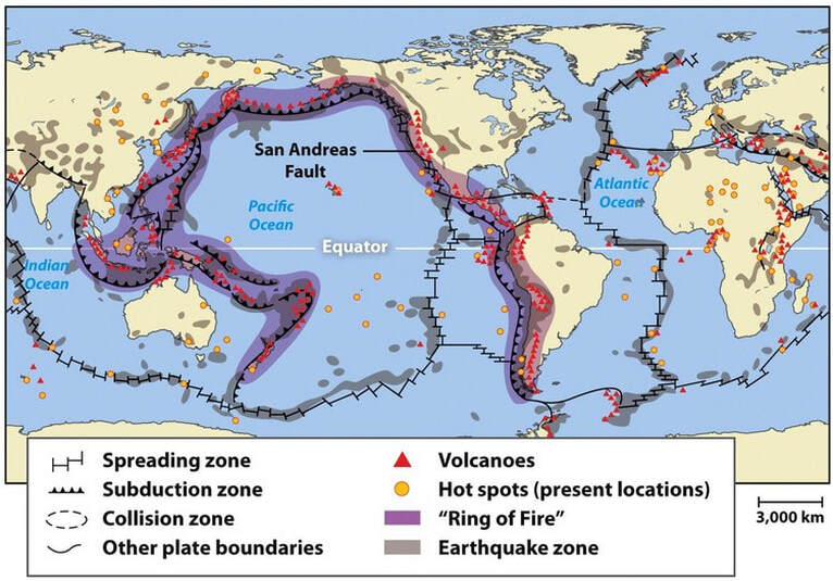
The Earth's surface is divided into several tectonic plates, which float atop the semi-fluid layer known as the . Most major earthquakes and volcanoes occur along the where these plates interact. These boundaries can be classified into three main types: divergent, convergent, and transform. Divergent boundaries occur where plates move each other, creating rift zones and mid-ocean . Convergent boundaries form when plates , leading to the formation of mountain ranges, deep-sea , and volcanic activity. Transform boundaries are characterized by plates past one another, often resulting in powerful earthquakes. Understanding plate boundaries helps us predict and mitigate the impact of these geologic events.
Continental vs. Oceanic Crust
Earth's crust can be categorized into two types: continental crust and oceanic crust. Continental crust, found beneath the continents, is in size, ranging from 25 to 70 kilometers in depth. It is primarily composed of dense rocks like , giving it a lower average density compared to oceanic crust. In contrast, oceanic crust is , averaging around 5 to 10 kilometers in depth. It consists mainly of rocks like basalt and has a average density. The contrasting properties of continental and oceanic crust play a significant role in shaping Earth's surface features, influencing the formation of mountains, deep-sea trenches, and volcanic activity.
Convection Currents and Plate Tectonics
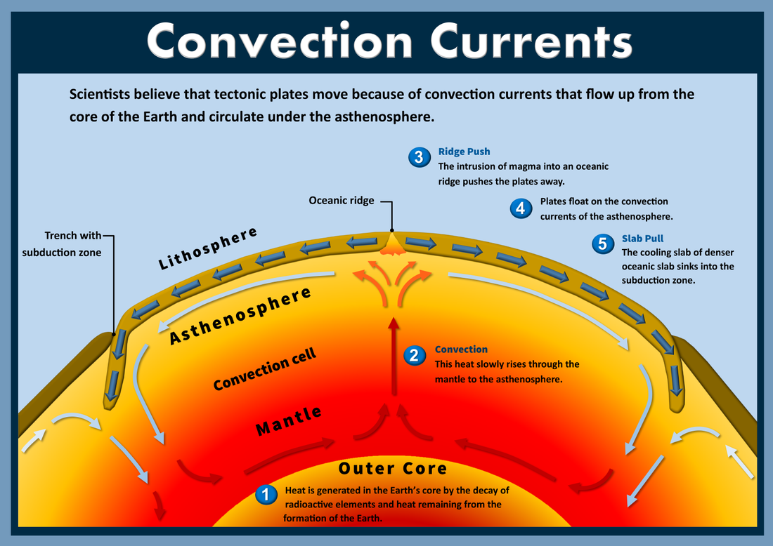
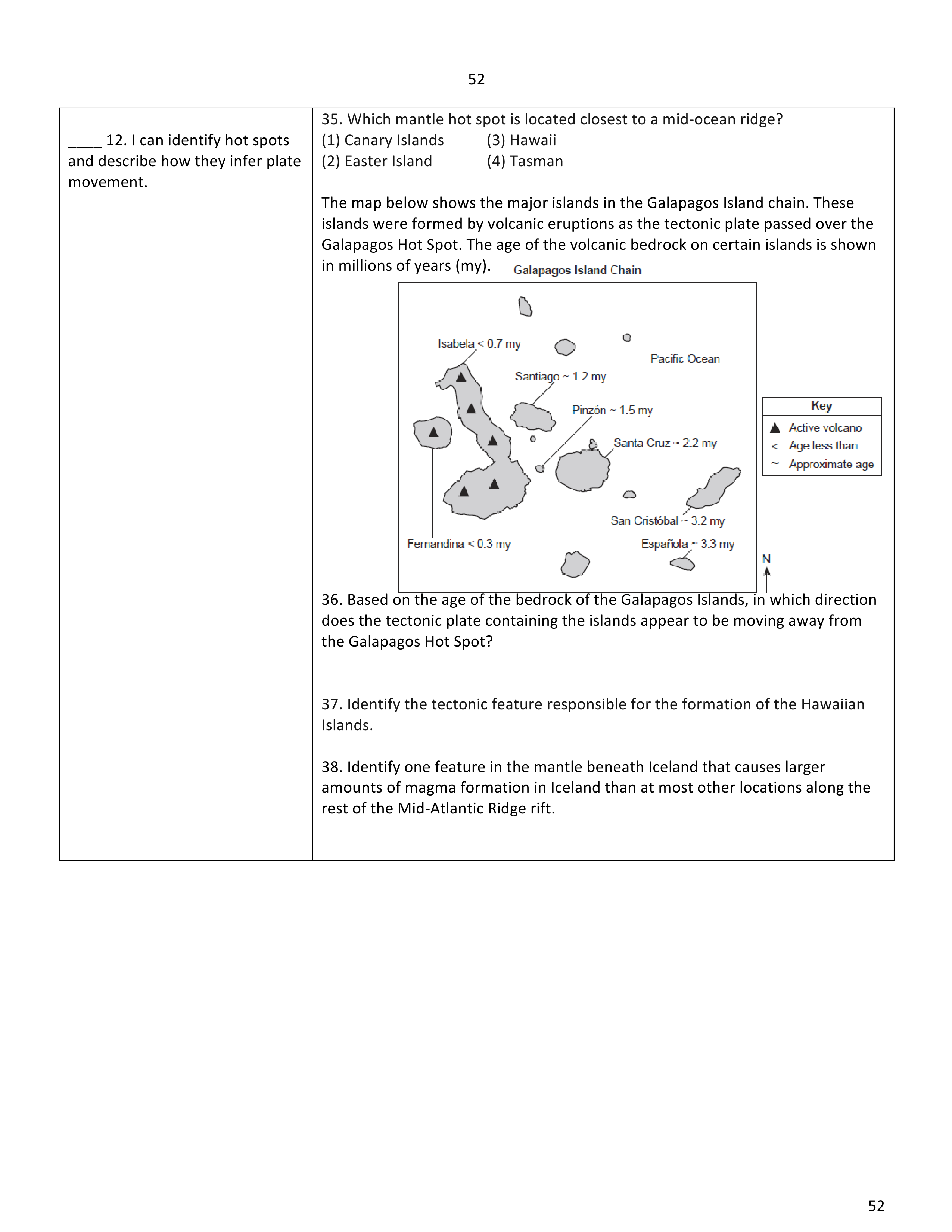
The driving force behind plate tectonics is currents within the Earth's mantle, the layer beneath the crust. Convection currents occur due to the unequal distribution of within the mantle. Heat from the Earth's core causes the molten rock within the mantle to , creating upwelling plumes. As these plumes reach the top of the mantle, they spread horizontally, carrying heat toward the surface. Upon reaching the cooler crust, the material cools, becomes denser, and back down, completing the convective cycle. These convection currents act as the engine that propels the movement of , driving processes such as seafloor spreading, subduction, and continental drift.