Log in
Sign up for FREE
arrow_back
Library
Chapter 1 History Alive
By Alejandra Martinez
star
star
star
star
star
Share
share
Last updated over 6 years ago
23 questions
Add this activity
1
1
1
1
1
1
1
1
1
1
1
1
1
1
1
1
1
1
1
1
1
1
1
Question 1
1.
globe
lines on a map that cirlde the Earth from east to west
the study of how our natural surrounding and how we interact with them
lines on a map that run from the north pole to the south pole
the most accurate map of the Earth
bodies of water and landforms, such as the Gulf of Mexico
lines on a map that cirlde the Earth from east to west
Question 2
2.
geographic terms
the study of how our natural surrounding and how we interact with them
words that describe bodies of water and land forms, like gulf and valley
lines on a map that run from the north pole to the south pole
the most accurate map of the Earth
bodies of water and landforms, such as the Gulf of Mexico
lines on a map that cirlde the Earth from east to west
Question 3
3.
latiude
the study of how our natural surrounding and how we interact with them
words that describe bodies of water and land forms, like gulf and valley
lines on a map that run from the north pole to the south pole
the most accurate map of the Earth
bodies of water and landforms, such as the Gulf of Mexico
lines on a map that cirlde the Earth from east to west
Question 4
4.
longitude
lines on a map that cirlde the Earth from east to west
bodies of water and landforms, such as the Gulf of Mexico
the most accurate map of the Earth
lines on a map that run from the north pole to the south pole
words that describe bodies of water and land forms, like gulf and valley
the study of how our natural surrounding and how we interact with them
Question 5
5.
geography
the study of how our natural surrounding and how we interact with them
words that describe bodies of water and land forms, like gulf and valley
lines on a map that run from the north pole to the south pole
the most accurate map of the Earth
bodies of water and landforms, such as the Gulf of Mexico
lines on a map that cirlde the Earth from east to west
Question 6
6.
physical features
lines on a map that cirlde the Earth from east to west
bodies of water and landforms, such as the Gulf of Mexico
the most accurate map of the Earth
lines on a map that run from the north pole to the south pole
words that describe bodies of water and land forms, like gulf and valley
the study of how our natural surrounding and how we interact with them
Question 7
7.
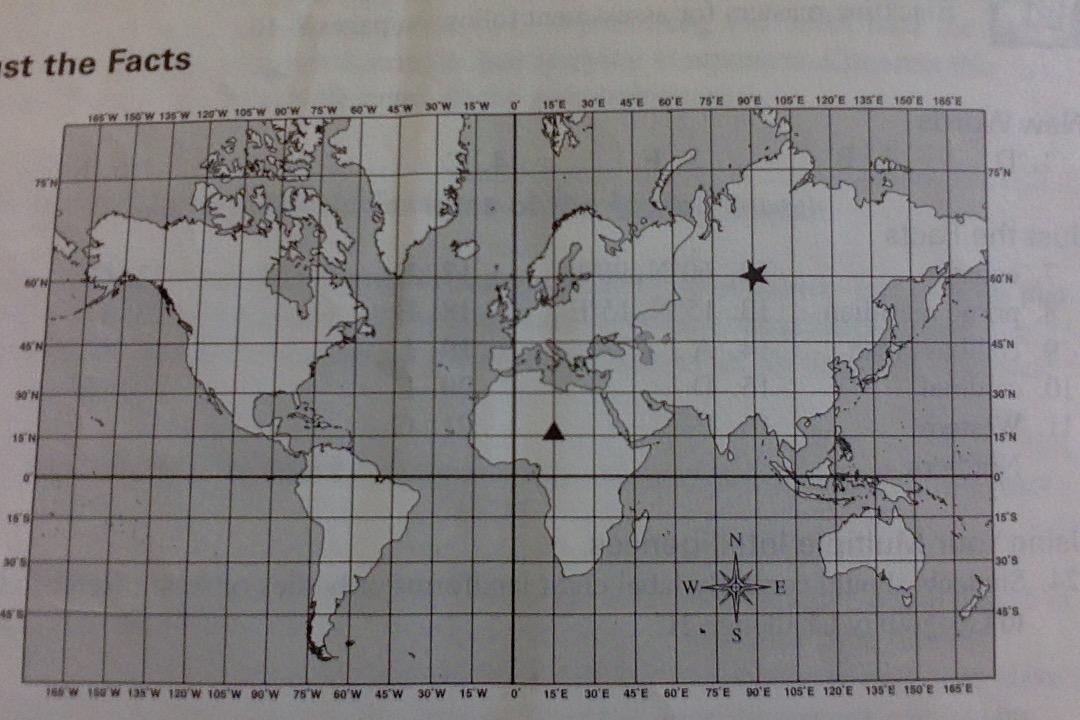
The line at 0 degrees latitude is called
Question 8
8.
The line at 0 degrees longitude is called
Question 9
9.
The symbol on a map that shows direction is called
Question 10
10.
The four main points on a compass are called the ___________________________ points
Question 11
11.
The North American continent is located in the ___________________ and ______________hemispheres.
Question 12
12.
The star on the map on the above is located at _____________latitude and __________longitude.
Question 13
13.
The triangle on the mapabove is located at ____________latitude and _________ longitude.
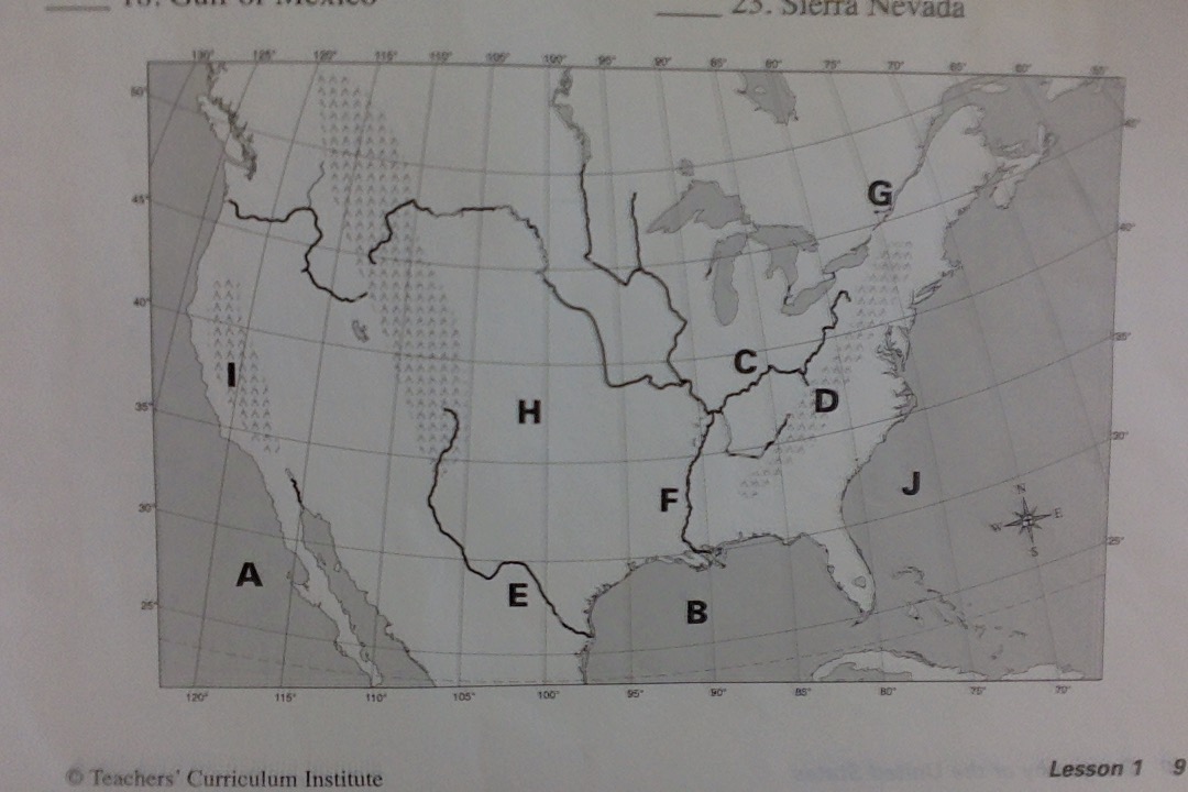
Question 14
14.
Pacific Ocean
Question 15
15.
Appalachian Mountains
Question 16
16.
Mississippi River
Question 17
17.
Great Plains
Question 18
18.
Gulf of Mexico
Question 19
19.
Atlantic Ocean
Question 20
20.
Rio Grande
Question 21
21.
St. Lawrence River
Question 22
22.
Ohio River
Question 23
23.
Sierra Nevada