
1
What is the name for the imaginary line at 0° longitude?
What is the name for the imaginary line at 0° longitude?
1
1
1
1
Where does the prime meridian pass through?
Where does the prime meridian pass through?
What is the name for the imaginary line at 0° longitude?
Where does the prime meridian pass through?
Lines to the left of the prime meridian are which direction?
Lines to the right of the prime meridian are which direction?
Where do lines of longitude come together?
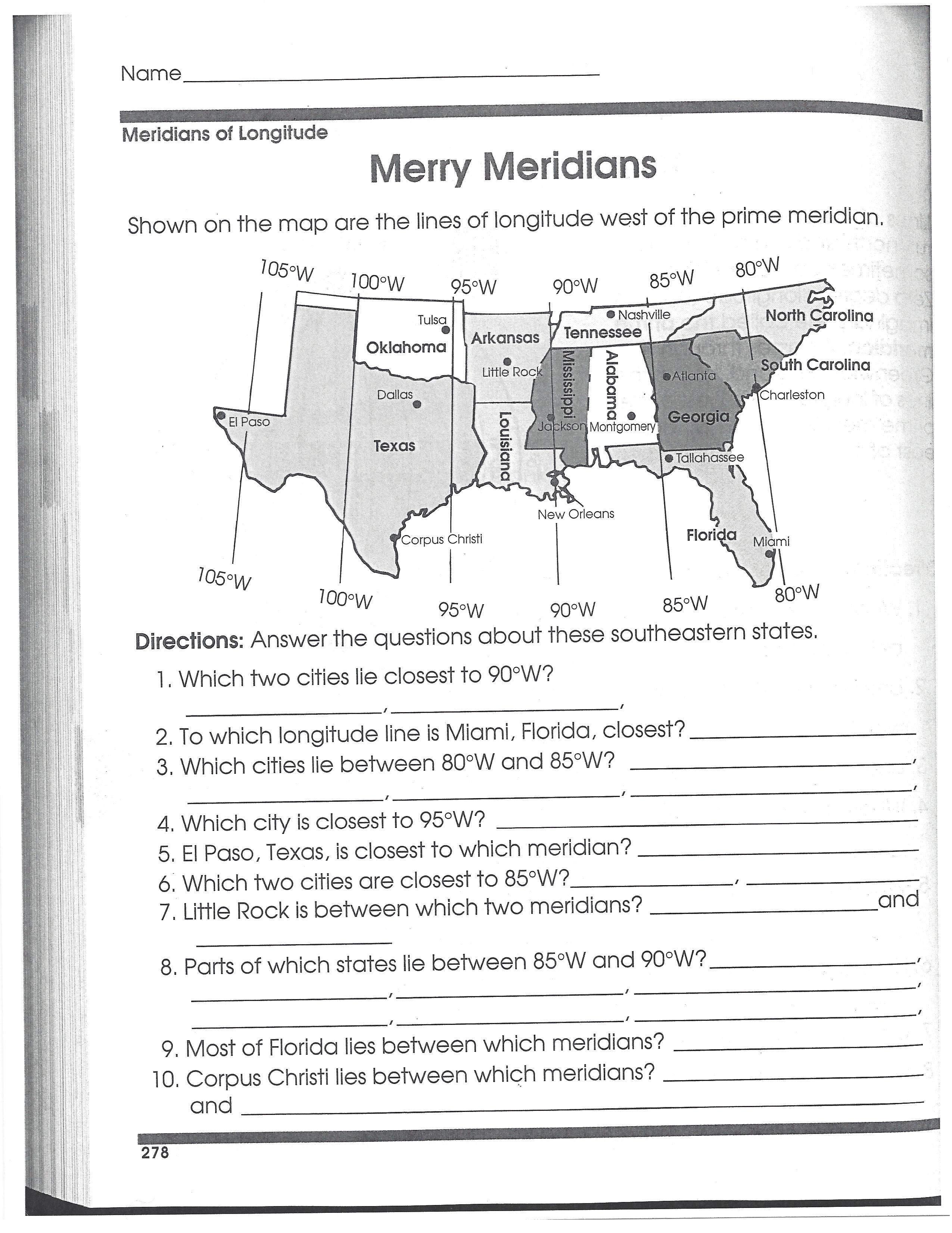
Which two cities lie closest to 90°W?
To which longitude line is Miami, Florida, closest?
Which cities lie between 80°W and 85°W?
Which city is closest to 95°W?
El Paso, Texas, is closest to which meridian?
Which two cities are closest to 85°W?
Little Rock is between which two meridians?
Parts of which states lie between 85°W and 90°W? There are 7!
Most of Florida lies between which meridians?
Corpus Christi lies between which meridians?
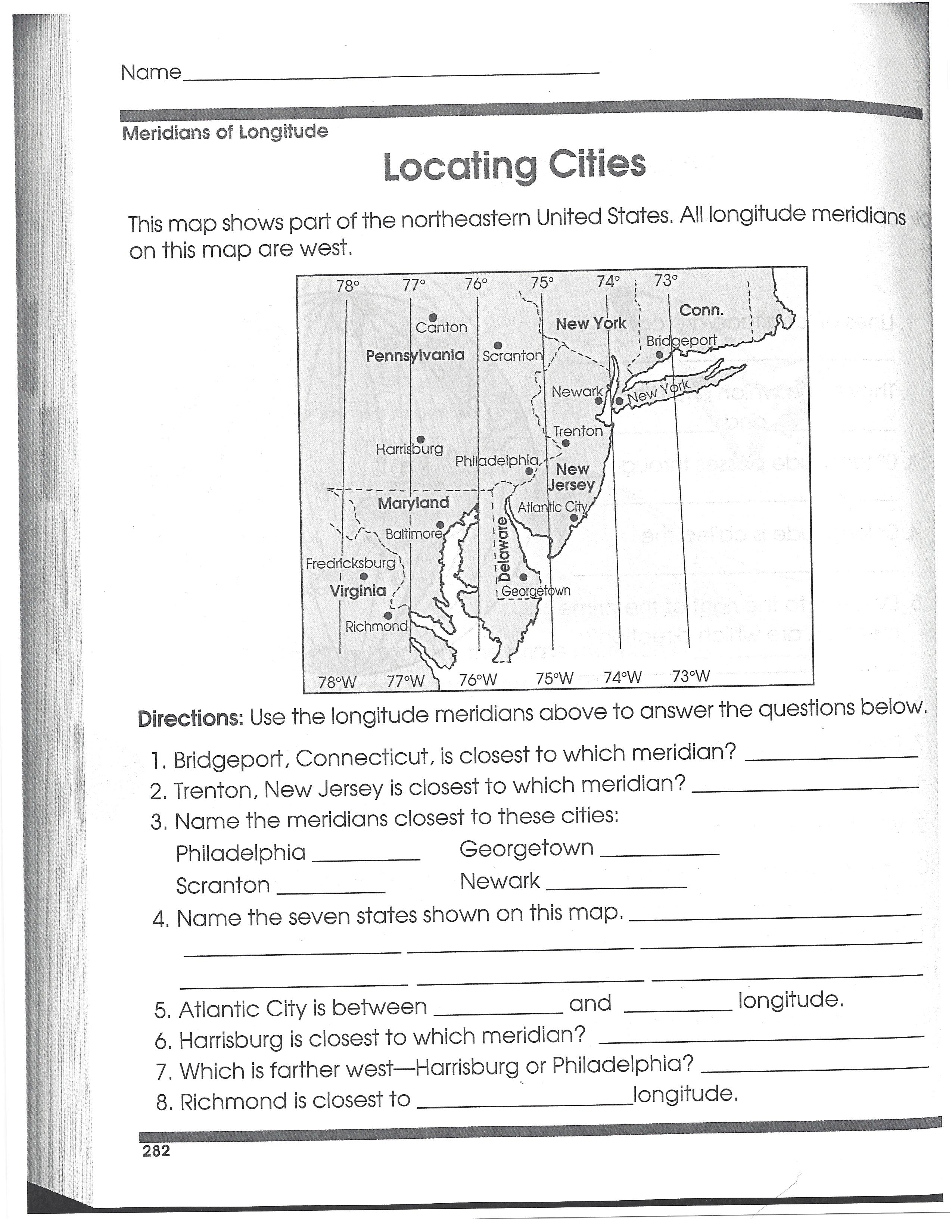
Bridgeport, Connecticut is closest to which meridian?
Trenton, New Jersey, is closest to which meridian?
Atlantic City is between which two longitude lines?
Harrisburg is closest to which meridian?
Which is farther west: Harrisburg or Philadelphia?
Richmond is closest to which longitude line?
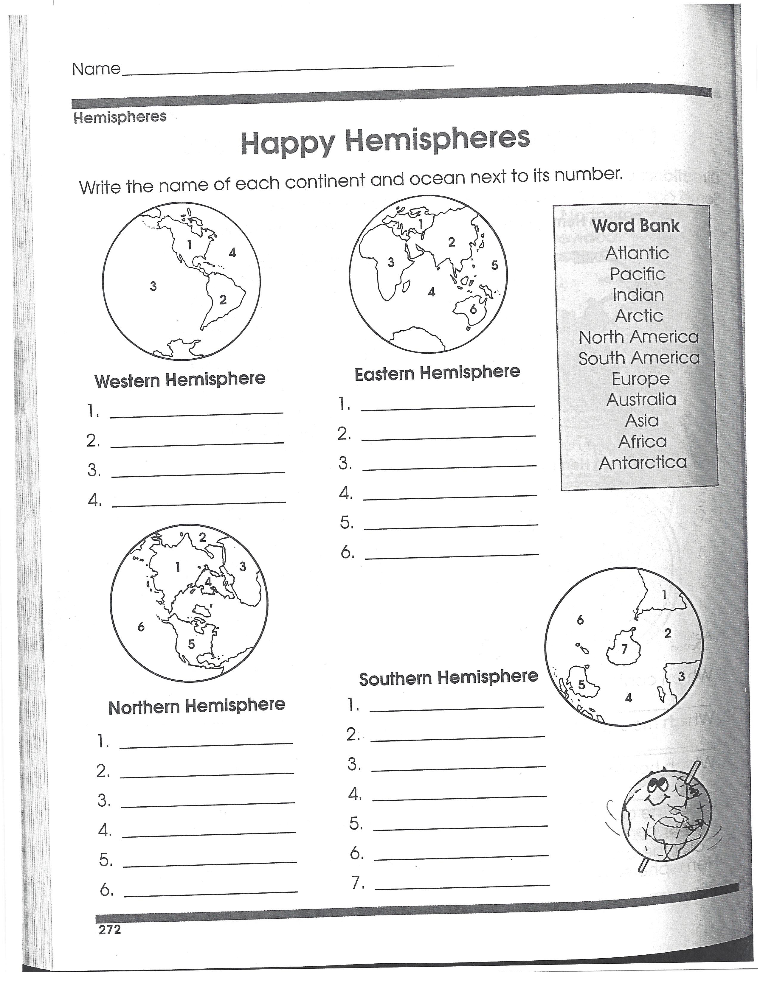
Choose the name of each contintent and ocean in the WESTERN HEMISPHERE
Choose the name of each contintent and ocean in the EASTERN HEMISPHERE
Choose the name of each contintent and ocean in the NORTHERN HEMISPHERE
Choose the name of each contintent and ocean in the SOUTHERN HEMISPHERE
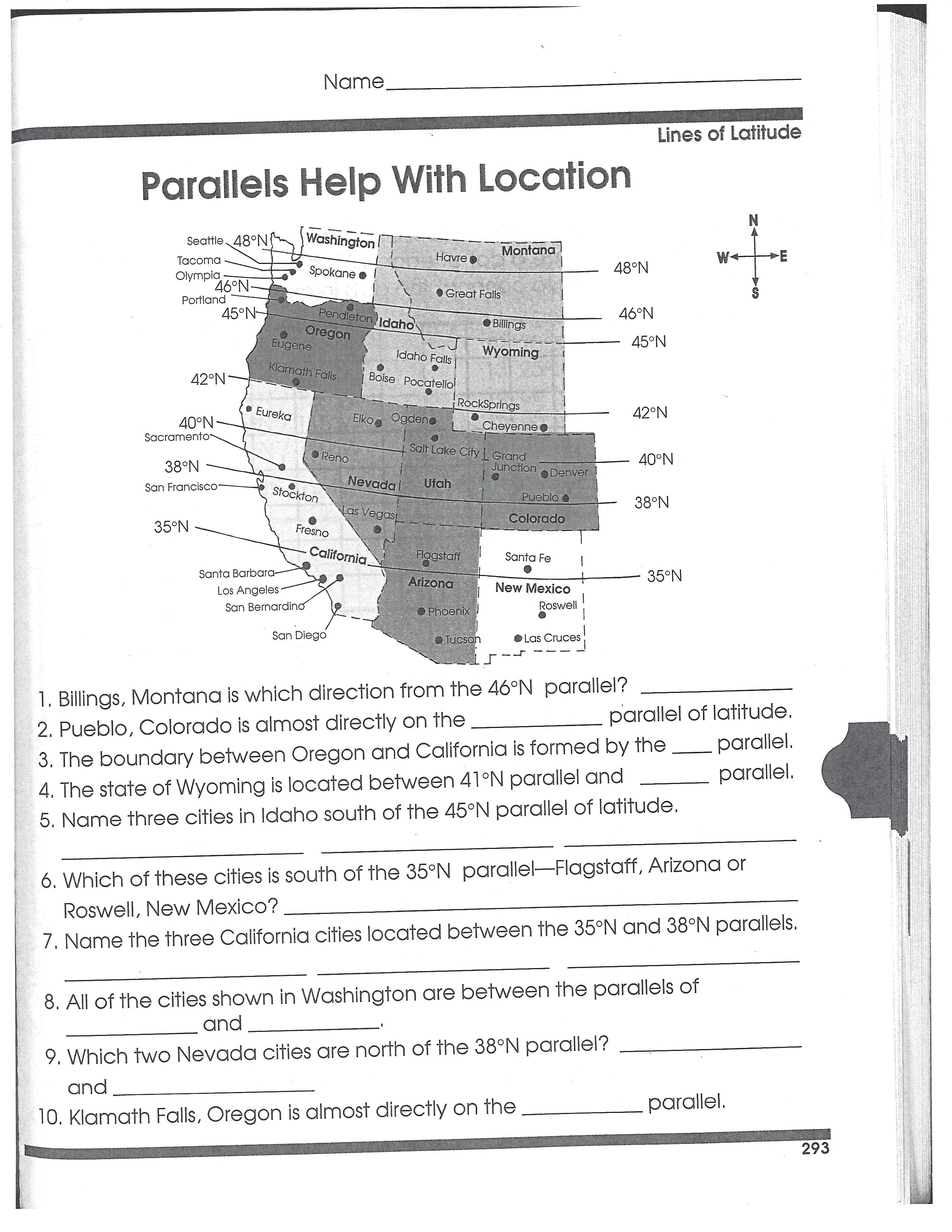
Pueblo, Colorado is almost directly on what parallel of latitude?
The boundary between Oregon and California is formed by what parallel?
The state of Wyoming is located between 41°N parallel and what other parallel?
Name three cities in Idaho south of the 45°N parallel of latitude:
Which of these cities is south of the 35°N parallel?
Name the three California cities located between the 35°N and 38°N parallels:
All of the cities shown in Washington are between which two parallels?
Which two Nevada cities are north of the 38°N parallel?
Klamath Falls, Oregon, is almost directly on what parallel?