MAPS TEST
star
star
star
star
star
Last updated almost 6 years ago
25 Nsɛmmisa
Hyɛ no nsow a efi ɔkyerɛwfo no hɔ:
Using maps to find information.
1
1
1
1
1
1
1
1

1
1
1
1
1

1
1
1
1
1
1
1
1
1
1
1
1
Using maps to find information.
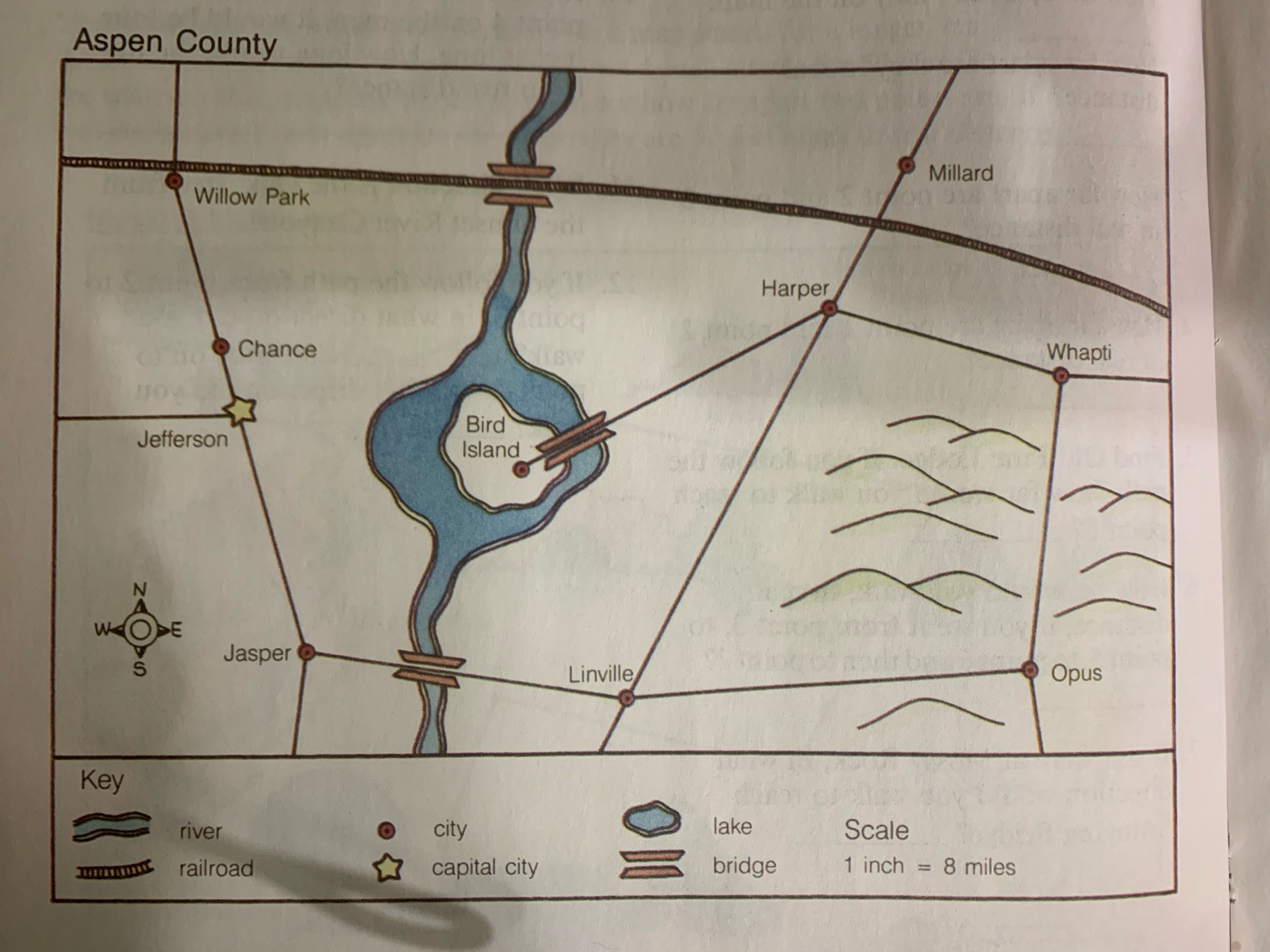
What is the capital city?
Which city does the railroad pass through?
Which is the shortest distance?
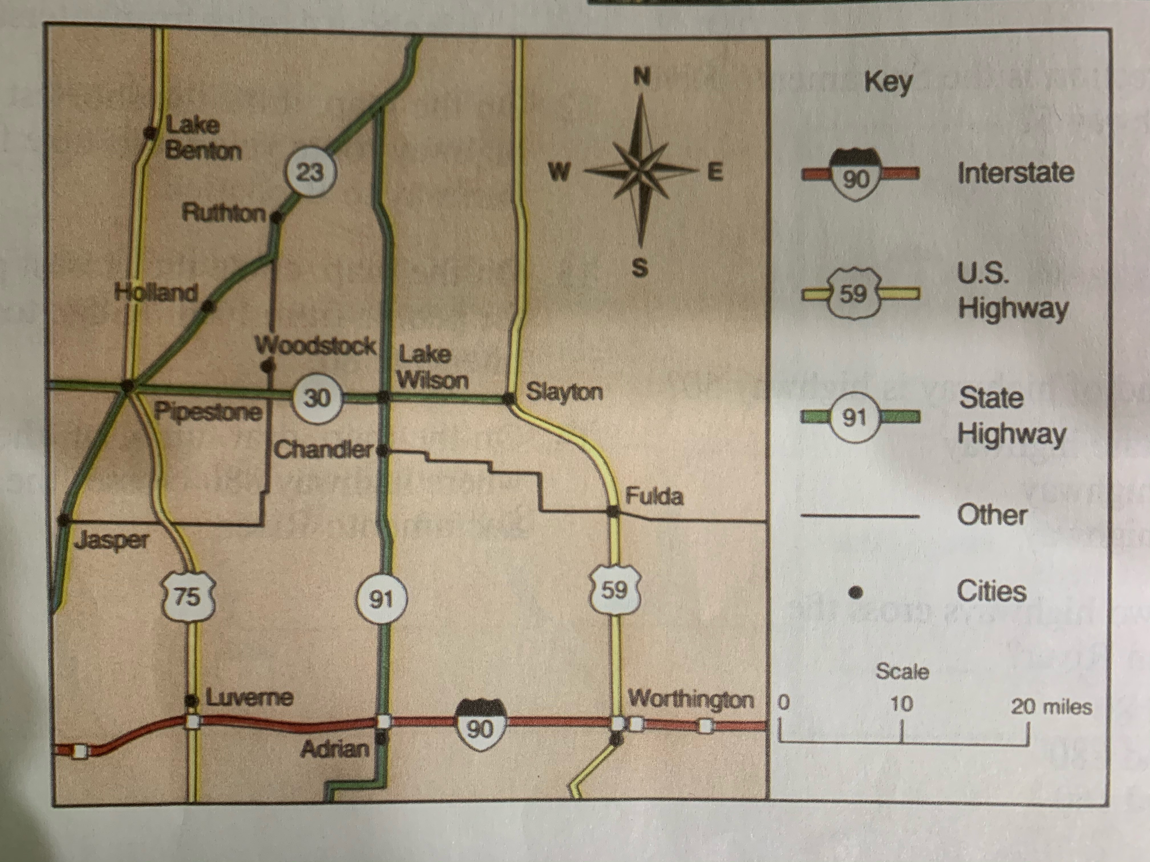
Which one of these is a U.S. Highway?
Which is the most direct route from Adrian to Slayton?
Which HWY runs NORTH and SOUTH through Pipestone?
What is the distance from Chandler to Adrian?
Find Woodstock on the map. What is the first city EAST of Woodstock on HWY 30
How many minerals are mined in GREENLAND?
What are 3 minerals mined in MEXICO?
In what country is BAUXITE found?
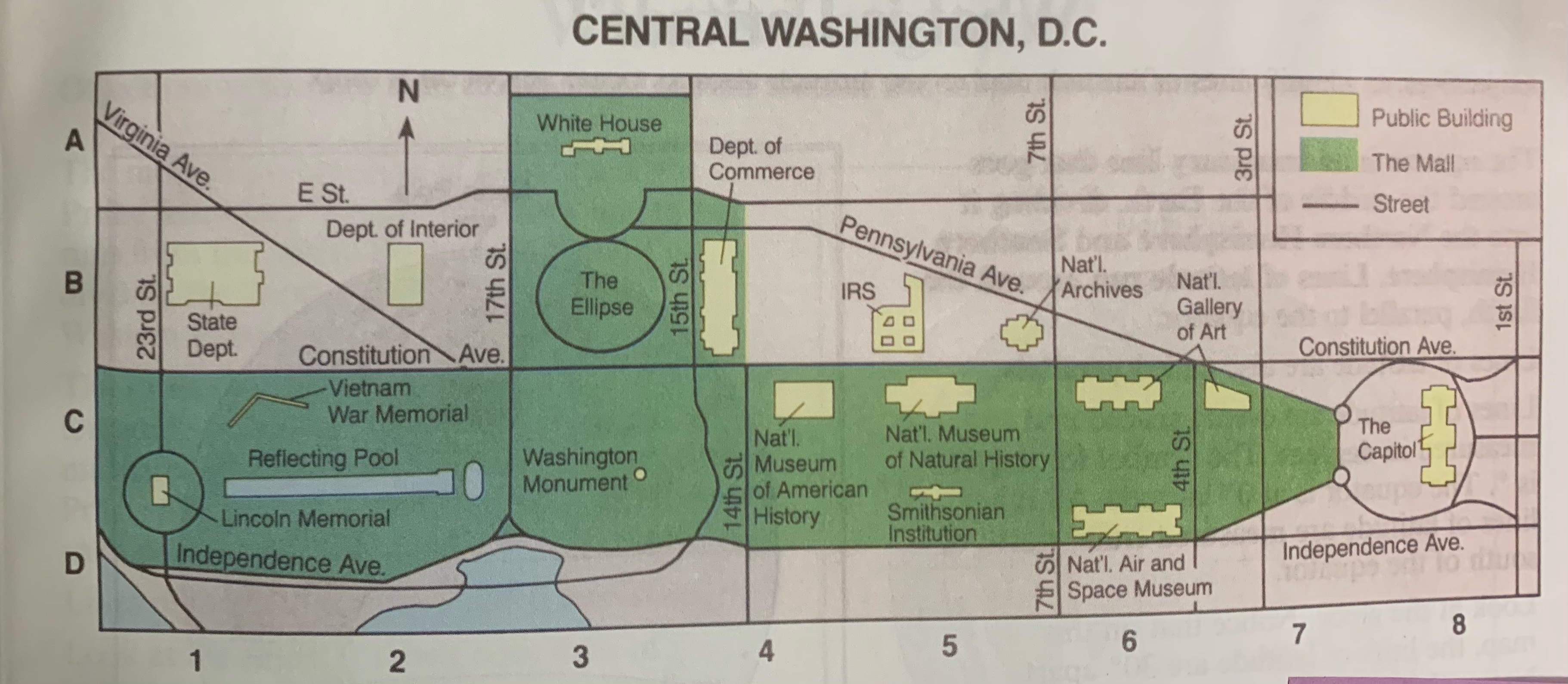
What building is located at C8?
What are the coordinates of the Washington Monument?
What does the color GREEN on the map represent?
Which HWY runs along the coastline and closest to Toronto Harbor?
If you are going from the University of Toronto to the Downsview Airport, which direction would you travel?
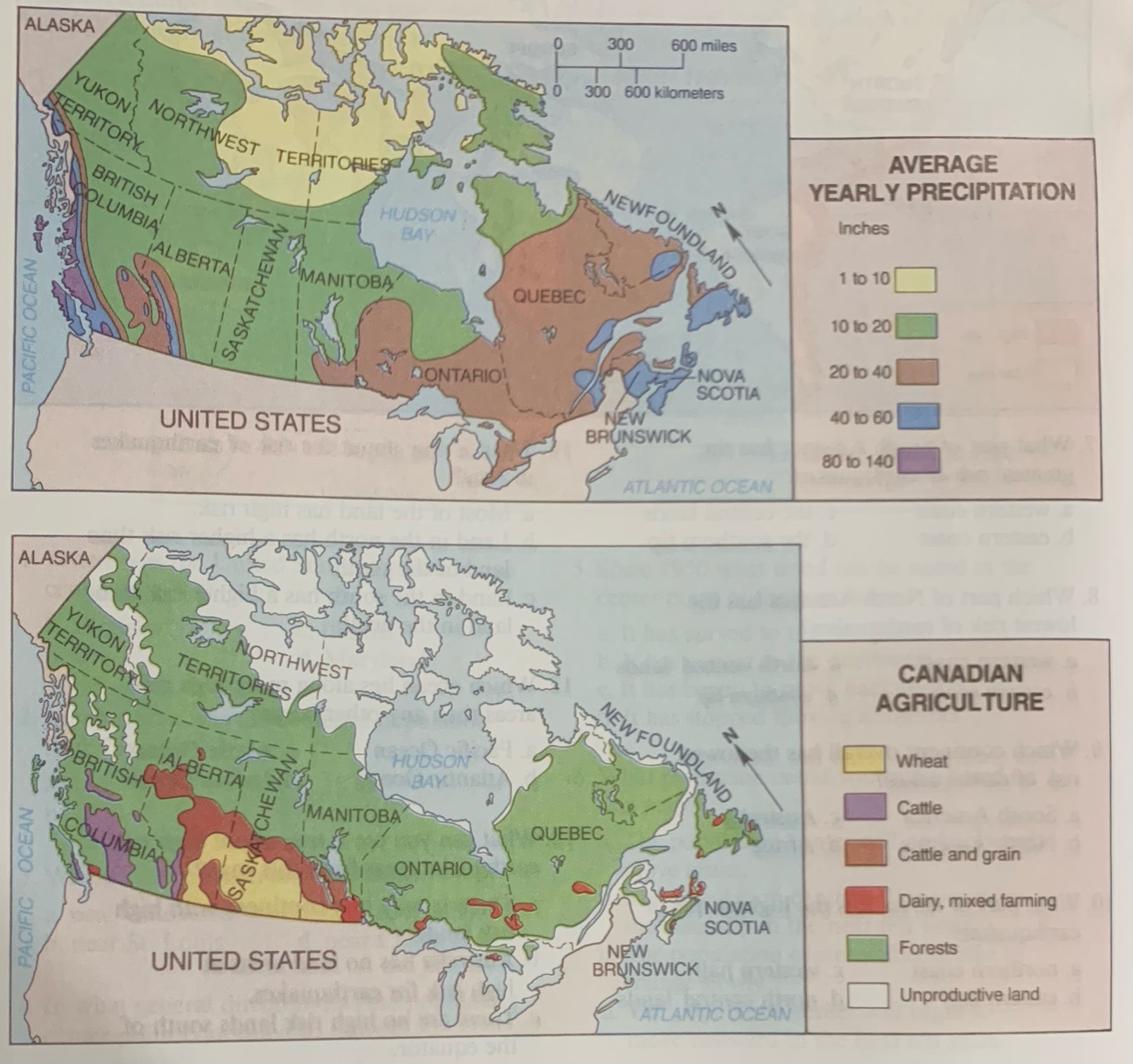
What is represented by the white areas on the agricultural map?
What do you think the category of unproductive land means? Use information from both maps to help you choose your answer.
What is an important product to British Columbia?
Where does the heaviest rainfall occur?
About how much rain is there in the wheat growing area of Canada?
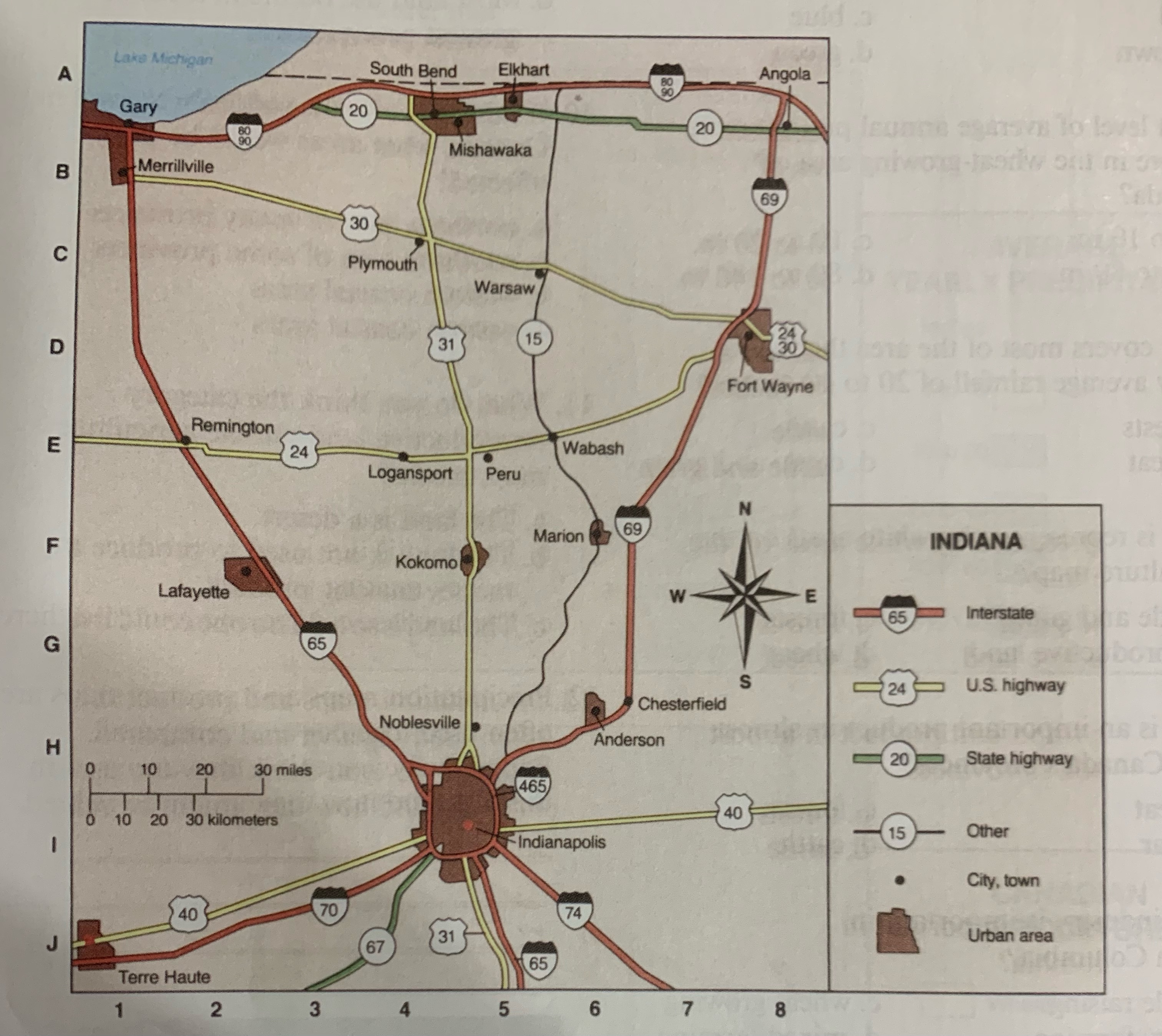
What city do you find at B-1
Where is South Bend located?
Which city is located in an URBAN AREA?
Which HWY running between TERRE HAUTE and INDIANAPOLIS is an interstate?