Log in
Sign up for FREE
arrow_back
Library
North America Phsycial and Political cloned 10/17/2020
By R HAAS
star
star
star
star
star
Share
share
Last updated over 5 years ago
10 questions
Add this activity
1
1
1
1
1
1
1
1
1
1
Using the North America Physical and Political Maps below answer the questions
Question 1
1.
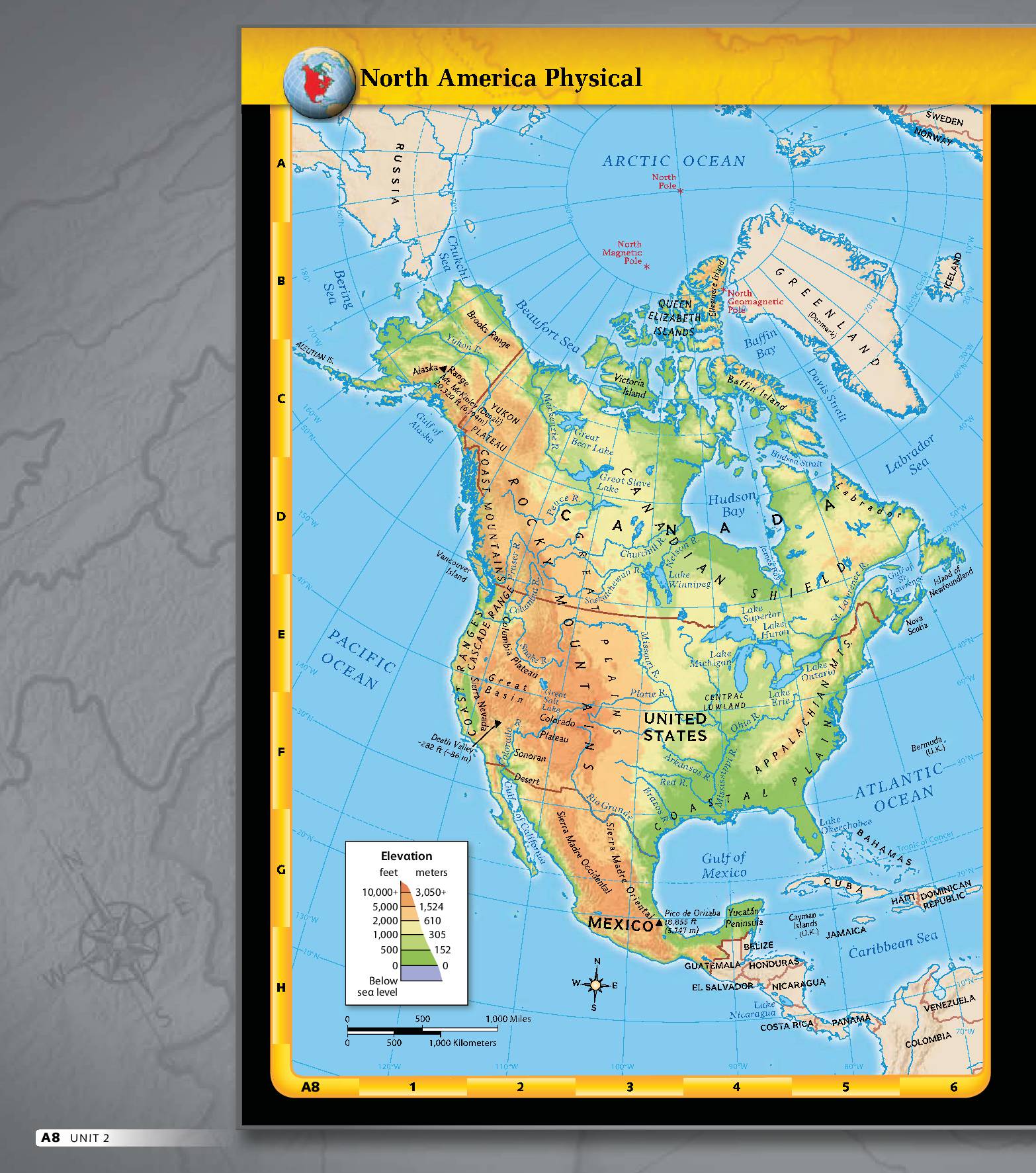
What is the title of the map?
United States Physical Map
North America Physical Map
North America Political Map
United States Political Map
Question 2
2.
(Using the map legend)
What is the name of the highest elevation area?
Great plains
Central Lowlands
Rocky Mountains
Coastal plains
Question 3
3.
(Using the map scale)
What is the closest distance listed below between Lake Michigan and the Gulf of Mexico on the map in miles?
about 500 miles
greater than 1000 miles
100 miles to the west
Question 4
4.
(Using the compass displayed on the map)
Where is the Yukon Plateau in relation to the Colorado Plateau?
North
East
West
Question 5
5.
(Using latitude and longitude lines)
What are the two lines the Rocky Mountains are located between?
150 degrees West to 130 degrees West
30 degrees North to 60 degrees North
30 degrees West to 60 degrees East
Question 6
6.
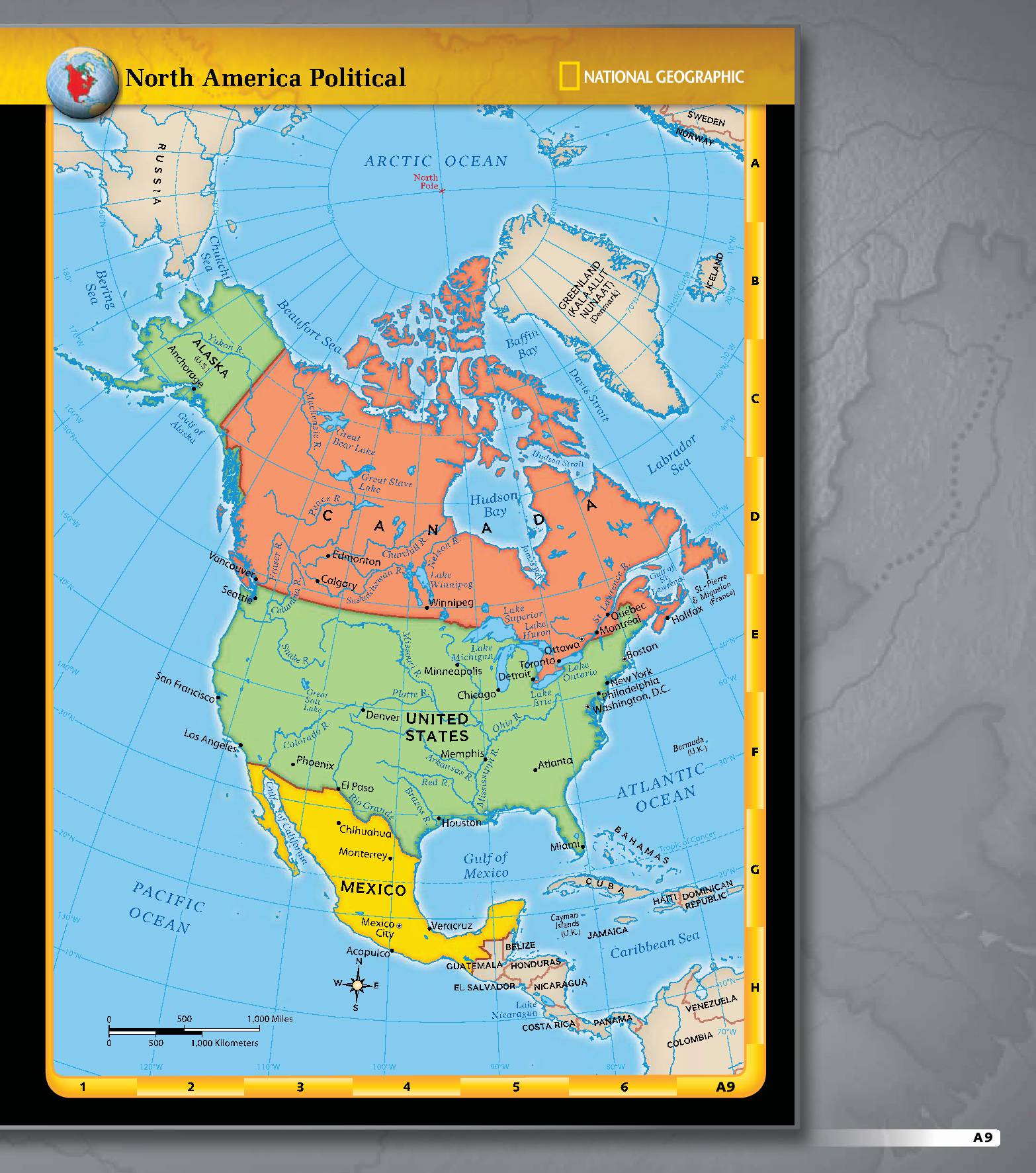
What are the three countries in North America?
Mexico, Alaska, and Canada
Canada, United States, and Mexico
United States, Greenland and Canada
Question 7
7.
What is the capital City of Mexico?
Washington D. C.
Moneterrey
Mexico City
El Paso
Question 8
8.
Which city is farther North on the map?
Phoenix
New York City
Seattle
Denver
Question 9
9.
What is the approximate distance in miles between Chicago and Denver?
500 miles
2000 miles
1000 miles
2500 miles
Question 10
10.
Where is Toronto in relation to Boston in direction?
North
West
East
South