TOPOGRAPHIC MAPS 8.9C
star
star
star
star
star
Posljednje ažuriranje about 5 years ago
6

17
SCI.8.9c

17
SCI.8.9c

17
SCI.8.9c
17
SCI.8.10a
SCI.8.9c

17
SCI.8.9c
17
SCI.8.9c
Whick side of this mountain has the STEEPEST slope?
What is the difference in elevation between point X and Y?
What is the highest point of elevation on this map?
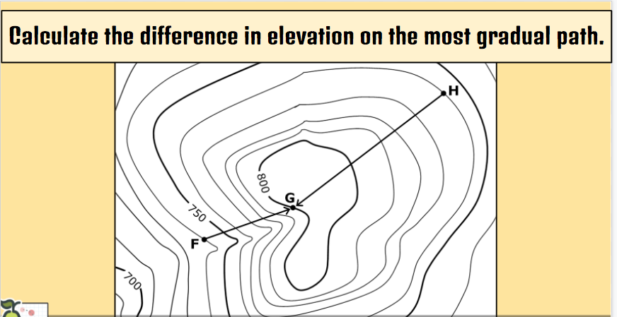
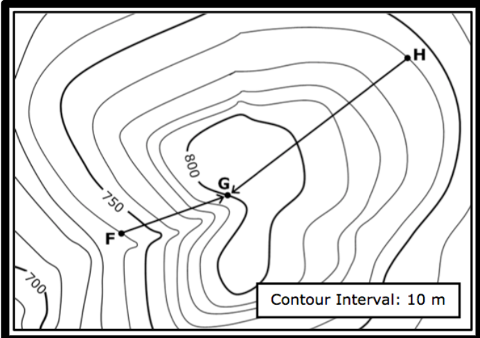
Calculate the difference in elevation on the most GRADUAL path.
What is the CONTOUR INTERVAL for this map?
Derrick started at point H and Sophia started at point F and started hiking up a hill. What is the change in elevation for the hiker who took the steepest path?