What is the tallest elevation measurement on this map?
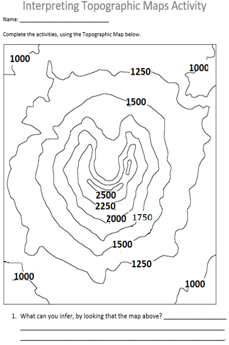
What is the tallest elevation measurement on this map?
The change in elevation from one contour line to the next is called the ____________________________________.
1Color the highest elevation on the map Red.
Color the lowest elevation on the map Green.
1. Color the elevation between 1750 and 2000 Yellow.
Color the elevation between 1250 and 1500 Blue.
If there were a Flood, draw a stickman to represent were you would want to be standing.
If you were in a boat, and wanted to float away as soon as it started to flood, draw a boat on the map, where you could easily float away.
Draw what you think this structure would look like if you were to see a photograph of the actual image:
What is the tallest elevation measurement on this map?
What is the lowest elevation measurement on this map?
What is the interval between each elevation?