Topographic Maps Engage
star
star
star
star
star
Posljednje ažuriranje about 5 years ago
7
1
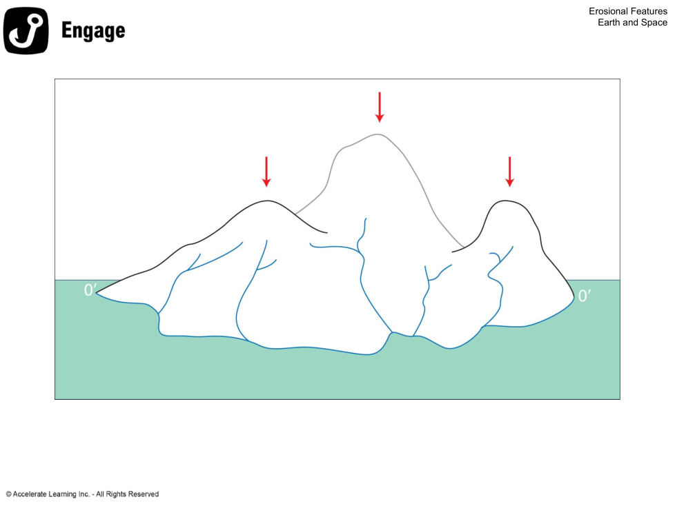
The red arrows point to the landform's
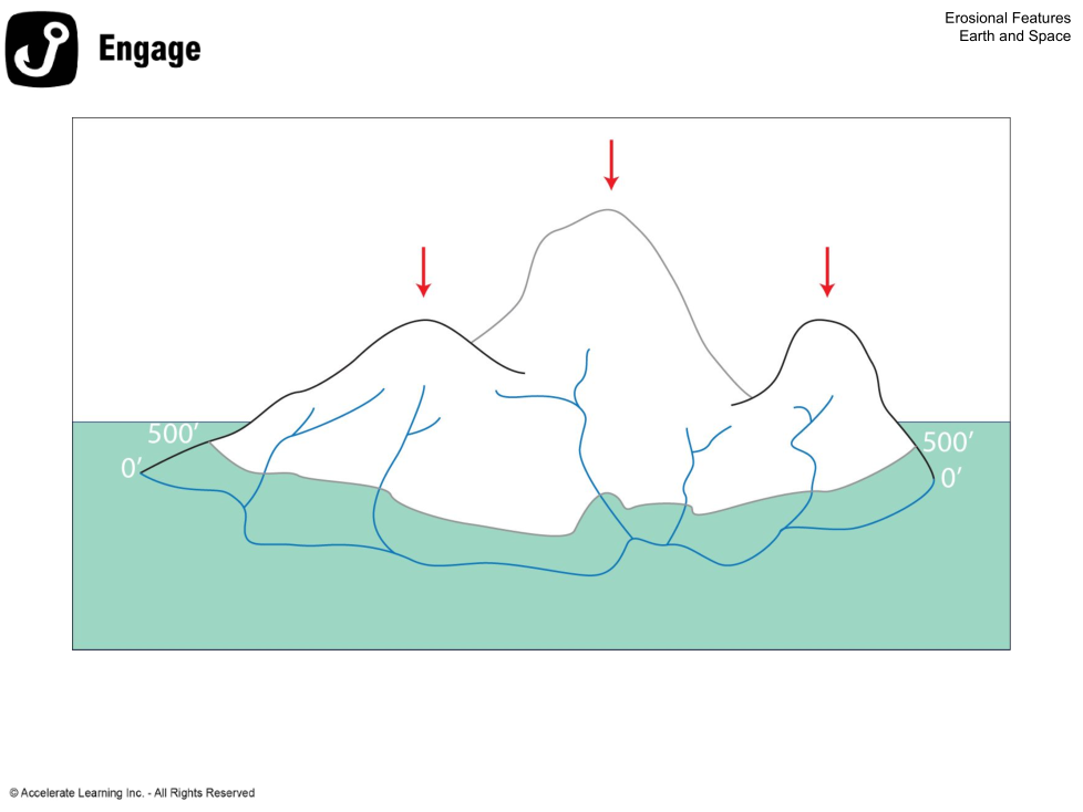
The elevation is 500 feet above sea level.
Each line is a CONTOUR LINE that surrounds the landform. What is the difference between each contour line?

This location is lower than the PEAKS and would be called a DEPRESSION.
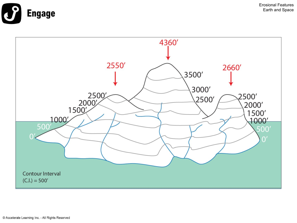
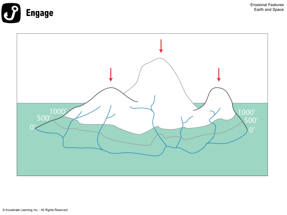
What is the highest elevation?
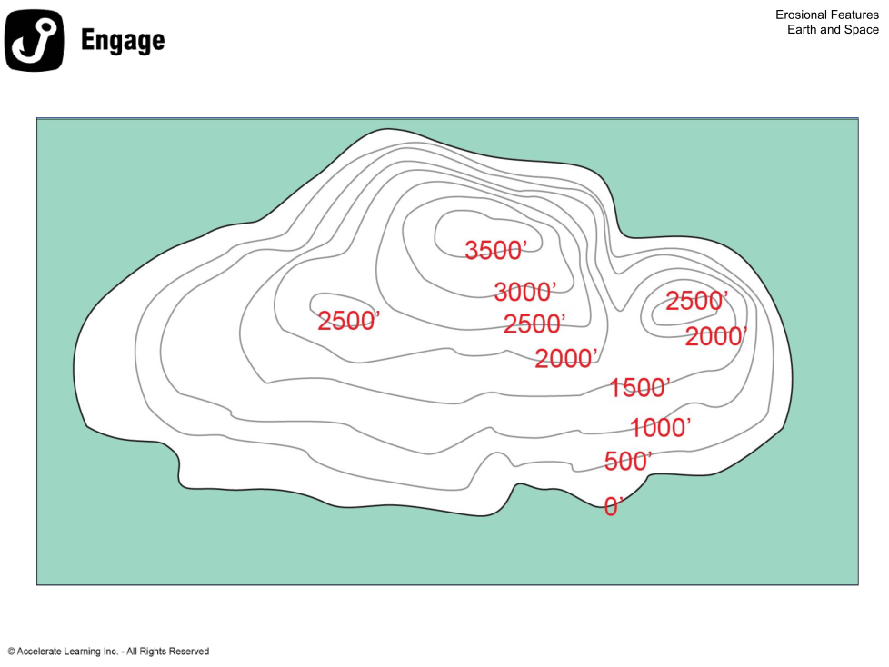
Is this a gentle or steep slope?
Is this a gentle or steep slope?