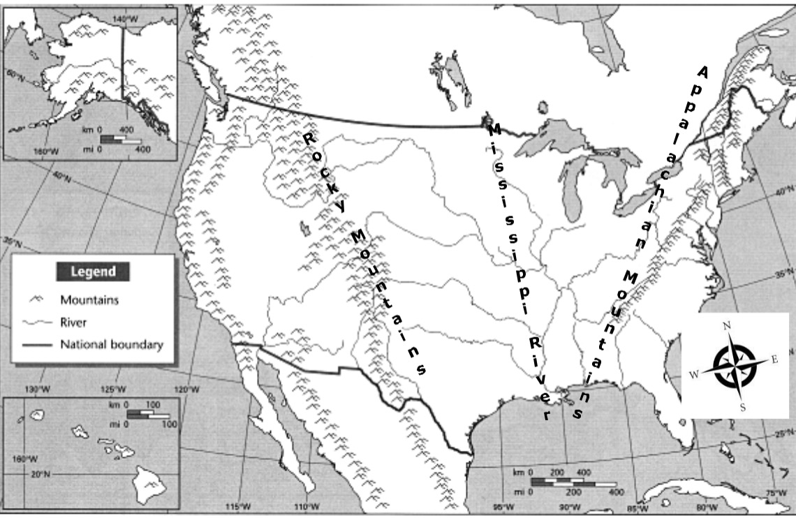
The Rocky Mountains are _______________ of the Mississippi River.
The Rocky Mountains are _______________ of the Mississippi River.
A tornado is an example of...
Anything that makes air, water or soil dirty or unsafe is called....
People can ______________ to cold weather by wearing warm clothes.
Using natural resources carefully is called....
Which of these is NOT a natural resource?
In a HOT, DRY climate, such as New Mexico, people are most concerned with the conservation of...
The Rocky Mountains are _______________ of the Mississippi River.
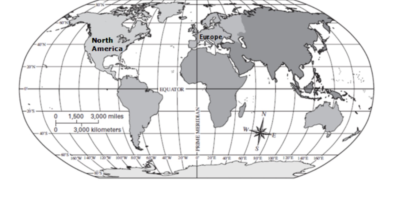
The _______________________ divides the Earth into Northern and Southern Hemispheres.
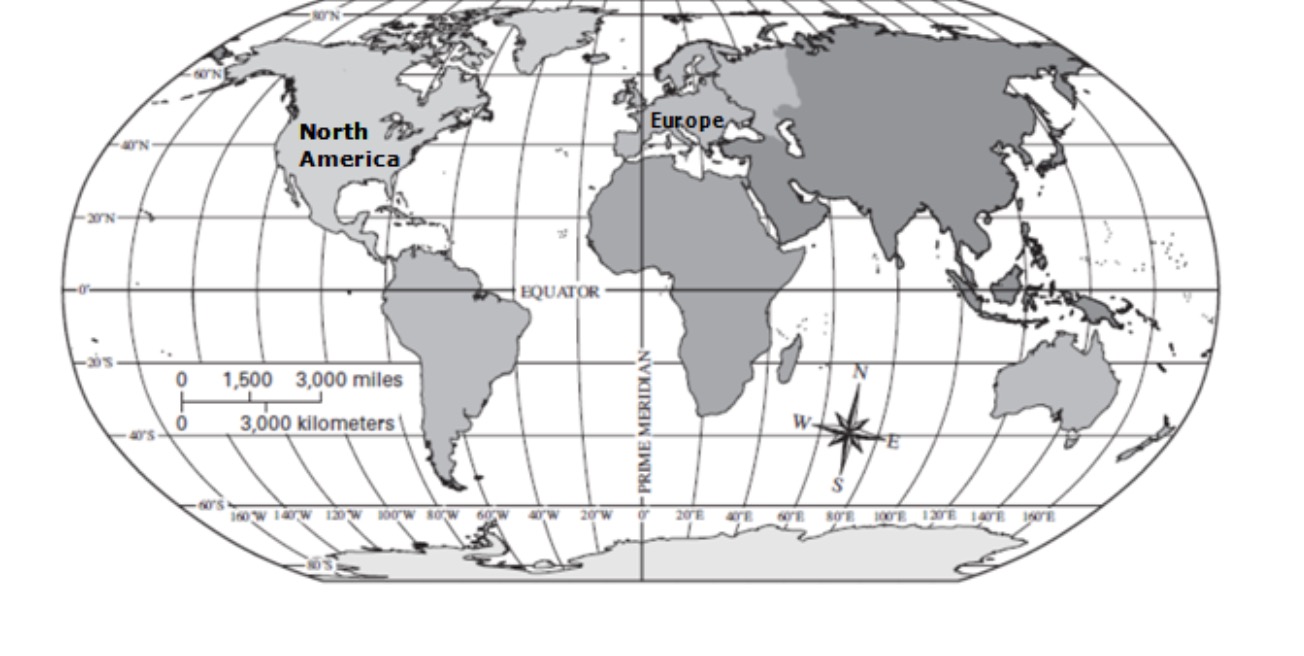
The _______________________ divides the Earth into Western and Eastern Hemispheres.
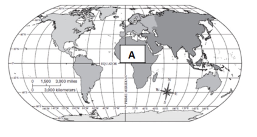
Which continent is labeled A on the map?
North, south, east and west are called _______________ directions.
Africa, Europe and North America are all examples of.....
The Atlantic and Pacific are examples of....
Which natural disaster worries people the most in Galveston, Texas?
Wood, water and land are examples of....
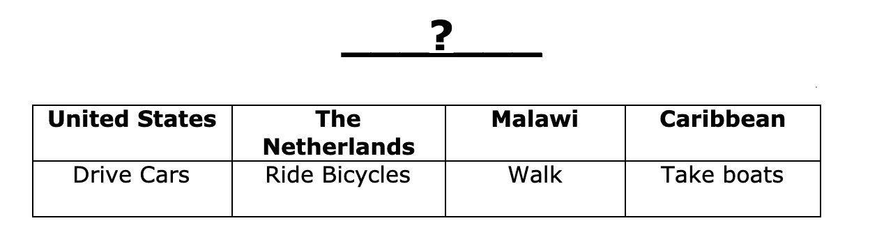
What is the best title for this chart comparing different parts of the world?
What state do we live in?
What is one way that people in Anchorage, Alaska adapt to their environment?
How many continents are there?
Where can you look to find out what symbols on a map represent?