what is the contour interval for this map.
what is the highest elevation ?
what is the contour interval of this map?
Place a Square ⬛️ over a location on the map that has a gentle slope
Place a heart ❤️ over a location on the map that has a steep slope
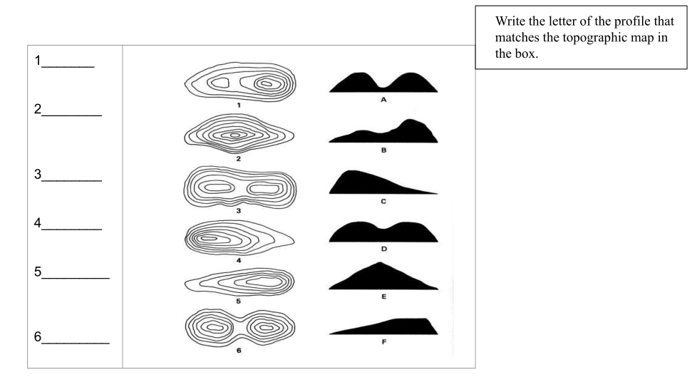
Map number 1 is landform___
Map number 2 is landform___
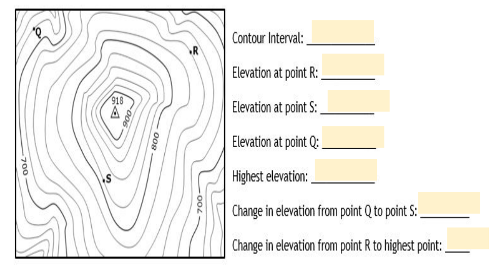
Conour interval
what is the conout interval for this map
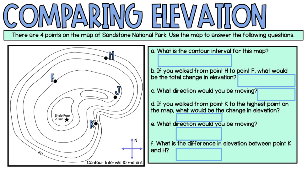
what is the change in elevation between H and F?
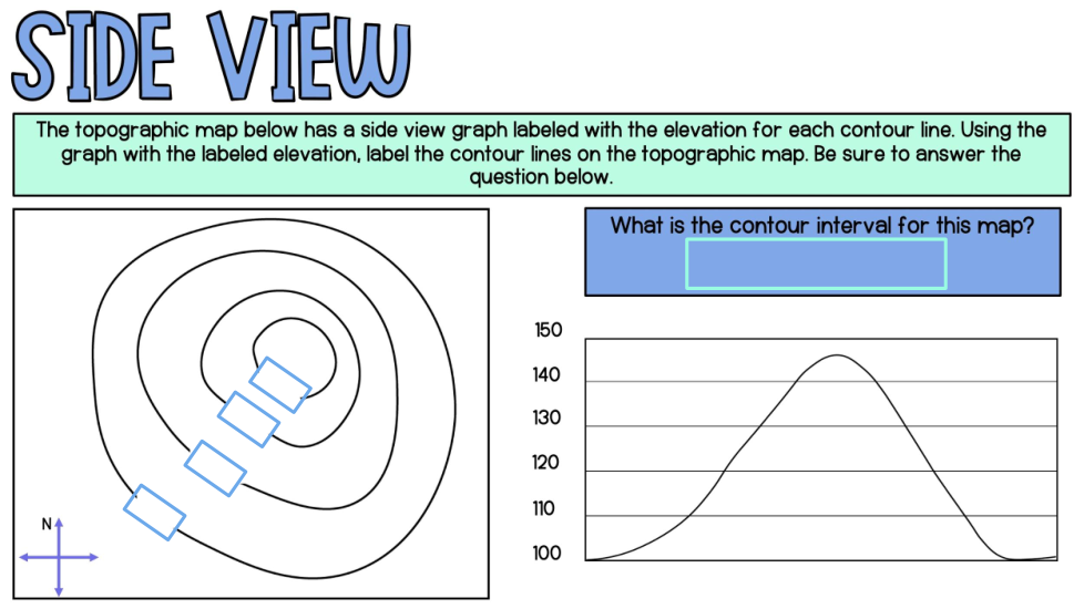
what is the contour interval for this map.
what is the elevation at this point
what is the elevation at this point
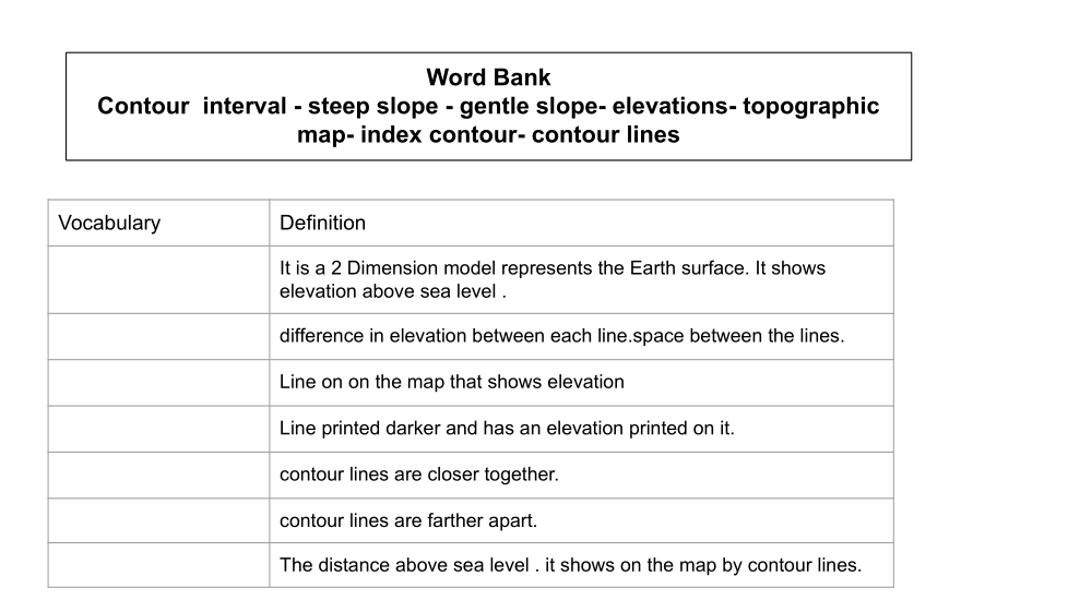
1 vocabulary is
2 vocabulary is
3 vocabulary is
4 vocabulary is
5 vocabulary is
6 vocabulary is
6 vocabulary is
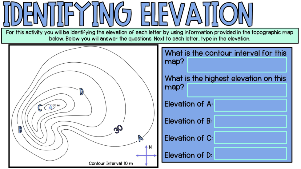
elevation of A
elevation of B
elevation of C
elevation of D
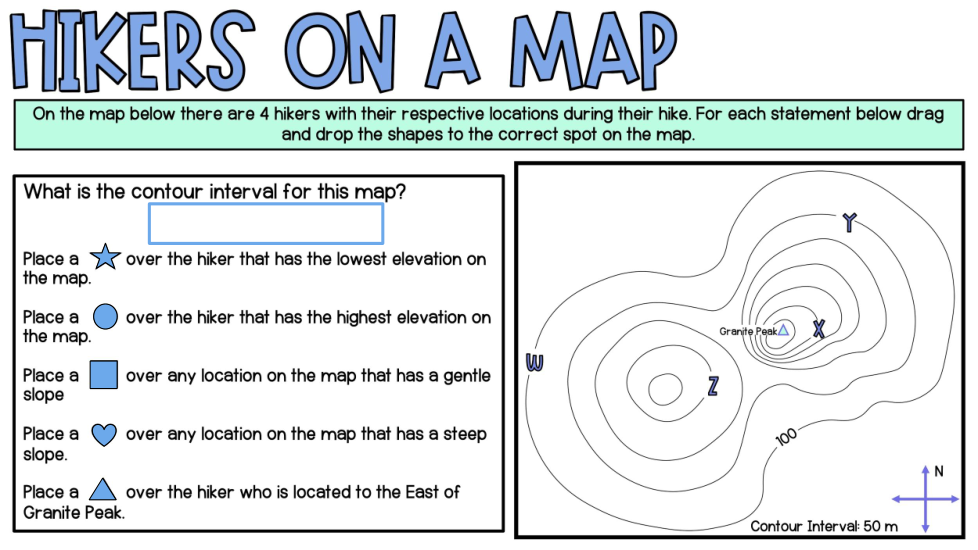
The hicker with the lowest elevation is__
The hicker with the highest elevation is__
The hicker that is located to the east of granite peak __
Map number 3 is landform___
Map number 4 is landform___
Map number 5 is landform___
Map number 6 is landform___
Elevation at point R
Elevation at point S
Elevation at point Q
highest elevation
change in elevation between Q and S
change in elevation between R and highest point
what direction would you be moving ?
if you walked from point K to the higest point on the map what would be the change in elevation ?
what direction would you be moving
what is the difference in elevation between point K and H
what is the elevation at this point
what is the elevation at this point