Glacier Thickness Analysis Assignment
star
star
star
star
star
Last updated over 5 years ago
6 Nsɛmmisa

1
1
3
3
3
5
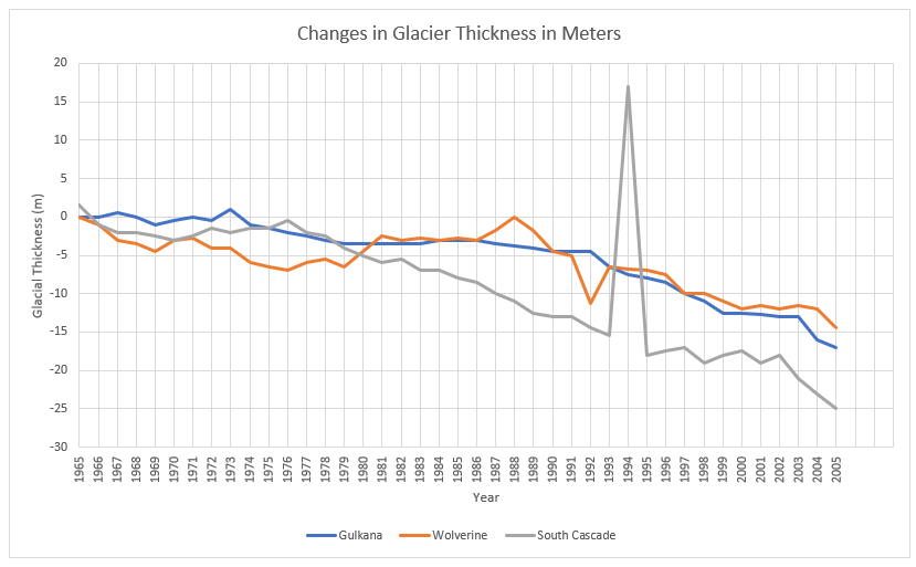
Based on the graph above.
Which glacier has the greatest thickness loss over the last 40 years?
Based on the graph above:
Which glacier has the least thickness loss?
Make a hypothesis (if....then....because) to explain how glacier location affects the thickness loss over time.
What do you think is the cause of the glaciers shrinking and growing over time? Please explain your answer.
What are 3 long term consequences that may occur if the glacial shrinking continues?
How do you think this trend could be slowed or even reversed? Please explain!