Log in
Sign up for FREE
arrow_back
Library
Making Sense of Climate Maps
By Larissa Beal
star
star
star
star
star
Share
share
Last updated almost 5 years ago
8 questions
Add this activity
1
2
zoom_in
1
1
3
4
5
6
7
8
zoom_in
1
1
1
1
1
1
Question 1
1.
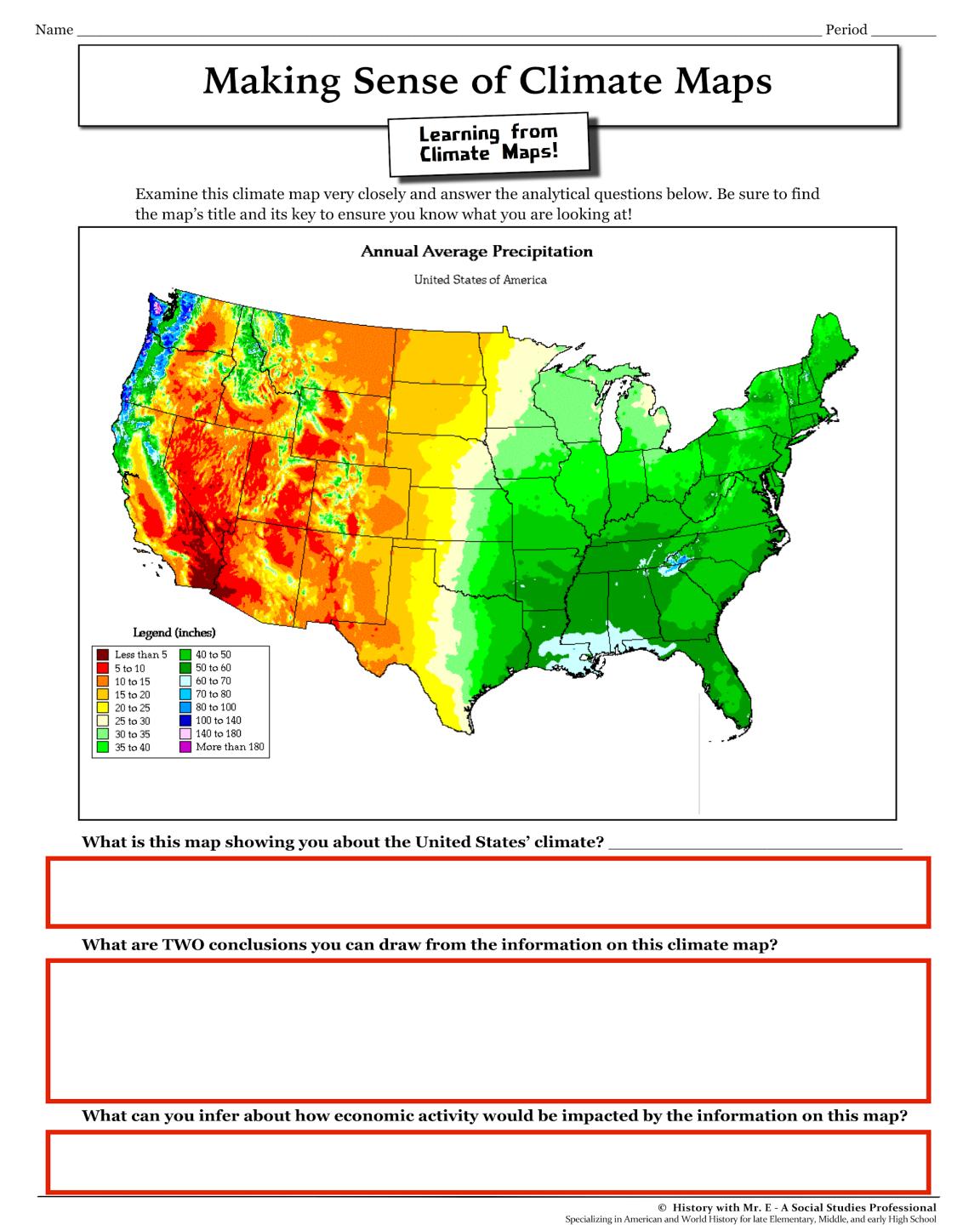
What is this map showing you about the United States' climate?
This map shows the different colors of land in the United States.
This map shows the annual average precipitation of the United States.
This map shows the average temperatures of the United States.
This map shows the average population of the United States.
Question 2
2.
What are TWO conclusions you can draw from the information on this climate map?
The East receives more precipitation than the West.
The West recieves more precipitation than the East.
The very Northwest receives the most precipitation.
It is warmer in the North than the South.
Question 3
3.
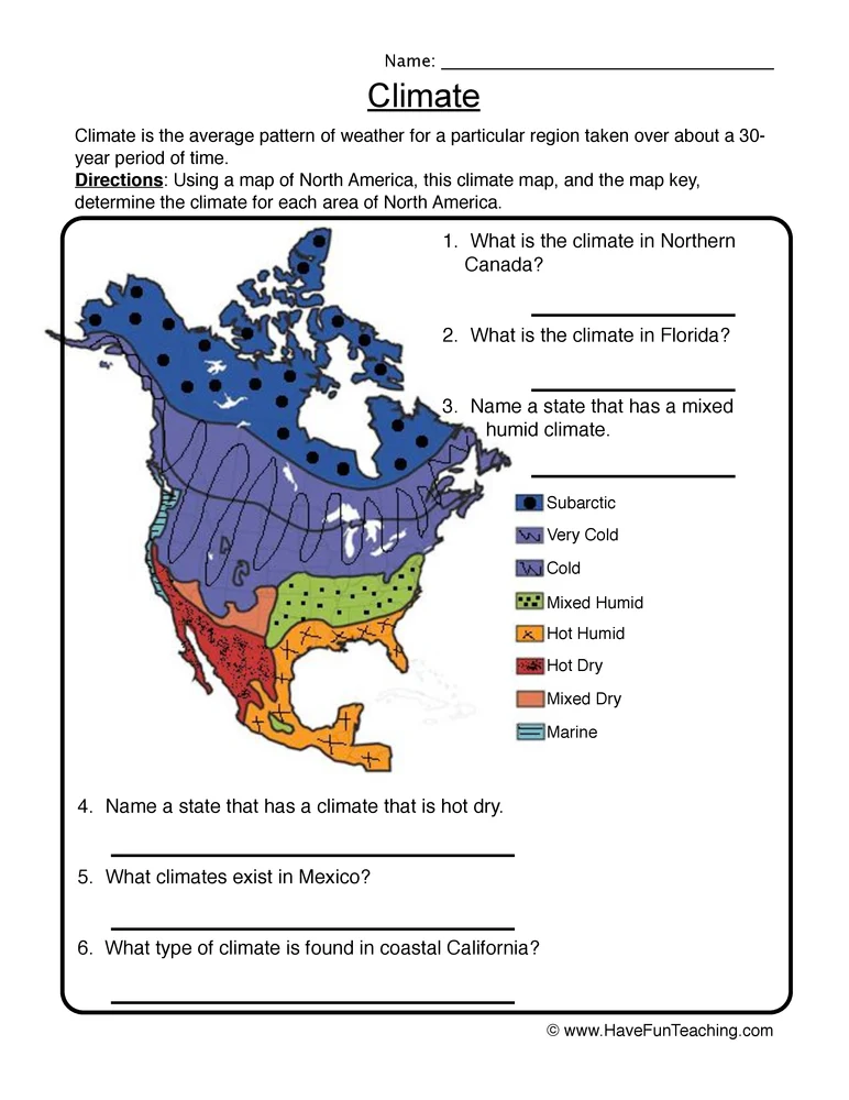
What is the climate in Northern Canada?
Hot Dry
Mixed Humid
Subarctic
Mixed Dry
Question 4
4.
What is the climate in Florida?
Subarctic
Very cold
Hot Dry
Hot Humid
Question 5
5.
Name a state that has a mixed humid climate.
Florida
Oregon
New Jersey
California
Question 6
6.
Name a state that has a climate that is hot dry.
Florida
California
Canada
New Jersey
Question 7
7.
What climate exists in Mexico?
Mixed Humid
Hot Humid
Very Cold
Subarctic
Question 8
8.
What type of climate is found in coastal California?
Marine
Cold
Subarctic
Hot Humid