Log in
Sign up for FREE
arrow_back
Library

Earth Science - Final

star
star
star
star
star
Last updated 8 months ago
32 questions
4
S5E1.c
4
S5E1.c
4
2
S5E1.a
3
S5E1.a
4
S5E1.b
4
S5E1.b
4
S5E1.a
3
S5E1.c
4
2
S5E1.a
3
S5E1.b
3
S5E1.b
4
S5E1.c
4
S5E1.b
4
S5CS7.b
3
1
1
Question 1
1.

Question 2
2.

Question 3
3.

Question 4
4.

Question 5
5.

2
S5E1.a
Question 7
7.

Question 8
8.

2
S5E1.a
4
S5E1.b
Question 11
11.

4
S5E1.a
4
S5E1.a
2
4
S5E1.c
Question 16
16.

4
S5E1.c
4
Question 19
19.

2
Question 21
21.

4
S5E1.c
Question 23
23.

Question 24
24.

1
S5E1.a
2
S5E1.a
Question 27
27.

Question 28
28.

Question 29
29.

Question 30
30.

Question 31
31.

Question 32
32.

A coastal town is experiencing significant shoreline erosion due to strong ocean waves. To protect both the beach and a nearby road that runs along the coast, engineers decided to build a solid structure that runs parallel to the shoreline. This structure is designed to absorb and reflect wave energy to prevent further erosion. What is this type of structure called?_______________.
Dam
Flood Plain
Levee
Sea Wall
A mountain town relies on a nearby river for water and electricity. To control the river’s flow, store water, and generate hydroelectric power, engineers construct a large barrier across the river. This structure can be opened or closed to manage water levels and prevent flooding downstream. What is this structure called?
sea wall
delta
levee
dam
Stone Mountain in Georgia is made of granite and was once buried deep underground. After being exposed by uplift and erosion, the surface of the mountain continues to change over time. Today, what natural process is most responsible for slowly breaking down the rock at the surface of the mountain?
erosion
sand dunes
weathering
deposition
After years of wind, rain, and temperature changes, the surface of a rocky hillside begins to crumble into smaller pieces of sediment. What is the name of the natural process causing this breakdown of rock and soil?
Weathering
Erosion
Landforms
Deposition
While visiting a city near a fault line, a person suddenly feels the ground shake beneath their feet. Scientists later explain that the shaking was caused by a sudden release of energy in Earth's crust. What natural event most likely occurred?
Glacier
Earthquake
Volcano
Hurricane
Question 6
6.

As a glacier slowly moves across the land, it scrapes and carves out valleys, breaking down rocks in its path. At the same time, it drops off sediment and builds up new landforms like moraines. What type of force is a moving glacier considered to be based on these effects?
Destructive
Composite
Constructive
Both Constructive and Destructive
Visitors to the Grand Canyon are amazed by its deep valleys and steep cliffs, carved over millions of years. Even today, natural processes continue to break down rock and carry sediment away, slowly changing the canyon’s shape. What forces are still at work causing these ongoing changes?
Weathering & deposition
Deposition & Chemicals
Weathering & Erosion
Erosion & Chemicals
Question 9
9.

Question 10
10.

Mount Rainier in Washington State hasn't erupted in over 500 years, yet scientists still consider it one of the most dangerous volcanoes in the Cascade Range. This is due to several factors, including frequent nearby earthquakes, an active hydrothermal system, its great height, and its thick glacier cover. Because it hasn’t erupted in centuries but still shows signs of activity, how would this volcano be classified?
Condensation
Dormant
Still
Active
Question 12
12.

Question 13
13.

Question 14
14.

Question 15
15.

From June 1 through November 30, beaches along the Florida coast are at risk of erosion due to hurricanes and strong storms. What is something that can be planted along the dunes to help hold the sand in place and minimize erosion?
corn and wheat crops
sea oats/beach vegetation
Palm Trees
build a fence
Question 17
17.

Question 18
18.

March 1886, in Rome, Georgia, rain began falling and continued for many days. The rainfall caused the Oostanaula and Coosa rivers to swell to 40.3 feet, the highest level ever recorded. Downtown Broad Street was 10 feet underwater. The city was drowning. As a result of this flooding, city officials determined that a __________ needed to be built to help prevent flooding of this magnitude from ever happening again. The structure still helps control flooding to this day.
jetty
flood plain
levee
sea wall
Question 20
20.

A scientist is studying a region around the edges of the Pacific Ocean where there are frequent earthquakes and many eruptions. This area is known for having a large number of active volcanoes. What is this region called, and what natural features give it its fiery name?
The Ring of Fur - too many fires
The Ring of Fire - it has many volcanoes
The horseshoe - its in a horeshoe shape
The Ring - it is in a complete circle
Question 22
22.

Engineers in northern regions often inspect roads more closely in early spring than at other times of the year. They frequently find that cracks and potholes have become significantly worse since the previous fall. This increase in road damage is linked to repeated cycles of water entering pavement cracks, freezing, expanding, and eventually breaking the surface apart. Which scenario best illustrates this type of mechanical weathering known as ice wedging?
A. Erosion of soil along riverbanks due to continuous water flow
B. Rocks and debris build up at the base of a cliff due to frequent rockfalls and landslides.
C. Large cracks and potholes appearing in roads after a cold winter season
D. Acid rain reacting with limestone statues, causing them to dissolve
While visiting the Grand Canyon, a student asks how such a massive canyon was formed. The park ranger explains that it was carved over millions of years by a natural process that slowly wore away rock and carried it downstream. What process was mainly responsible for forming the Grand Canyon?
Erosion from the Colorado River
Volcanoes building up land
Glaciers dragging rock across the land
Earthquakes shifting rock layers
Question 25
25.

Question 26
26.

In the 1930s, a structure was built on the Colorado River to help control flooding, store water, and provide electricity to the surrounding region. This massive structure blocks the flow of the river, creating a reservoir. The water stored behind it can be released to flow through turbines, generating a renewable source of energy.

Which structure was built to hold back the river, and what type of energy is produced when the water flows through turbines?
Levee; wind energy
Bridge; solar power
Canal; geothermal energy
Dam; hydroelectricity
A coastal community has been experiencing increased beach erosion after several strong storms. Residents have noticed that sand dunes are disappearing, and nearby buildings are at greater risk of damage. Scientists recommend planting sea oats and other native plants along the dunes to help solve the problem.
Why would planting vegetation like sea oats help protect the coastline from further erosion?
The plants create more sand by breaking down rocks.
Vegetation slows down the air flow, making the air cooler.
The roots of the plants hold the sand in place, reducing erosion.
Plants soak up seawater, stopping waves from reaching the shore.
Two students in Rome, Georgia are discussing whether a volcano could form in their backyard.

Jordan’s claim:
“A volcano could form here because magma can push through the Earth’s crust anywhere if the pressure builds up enough.”

Taylor’s claim:
“A volcano is unlikely here because Rome, Georgia is far from tectonic plate boundaries and hot spots, and it’s on the Atlantic side—far from the Ring of Fire where most volcanoes occur.”

Which student’s claim is scientifically correct, and why?
Jordan is correct because magma can break through the crust anywhere at any time.
Taylor is correct because volcanoes generally form near plate boundaries or hot spots, and Georgia is not located near these areas.
Jordan is correct because Georgia experiences frequent volcanic activity.
Taylor is correct because volcanoes only form in deserts and mountains.
The 1906 San Francisco earthquake caused widespread destruction, leveling buildings and infrastructure across the city. However, the tectonic activity that caused the quake also contributed to the uplift of the surrounding mountain ranges and the formation of new geological features along the San Andreas Fault.

Using this example, explain how earthquakes can simultaneously be destructive and constructive forces on Earth’s surface.
Earthquakes are minor geological events with no lasting impact on the landscape or human activity.
Earthquakes create new landforms by moving the Earth’s crust, but never cause damage to human structures.
Earthquakes only cause destruction, such as collapsing buildings and damaging roads.
Earthquakes can destroy human-made structures while also reshaping the Earth’s surface by uplifting mountains and creating faults.
The Hawaiian Islands were formed slowly over millions of years by lava coming out of a volcano and building up land. What kind of Earth process is this, since it creates new land?
hot
constructive
destructive
rapid
Some people who live in coastal areas along cliffs are using drones to take pictures of their
neighborhoods. A drone is a flying vehicle without a pilot on board. The two pictures show CHANGES in the cliff near a building on two different days in December. Which question can be answered by using a drone to observe changes along coastal areas?
How fast are the cliffs eroding?
How many people live near cliffs?
How old are rock layers at the bottom of the cliff?
How can people stop deposition of cliffs near the coast?
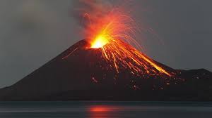
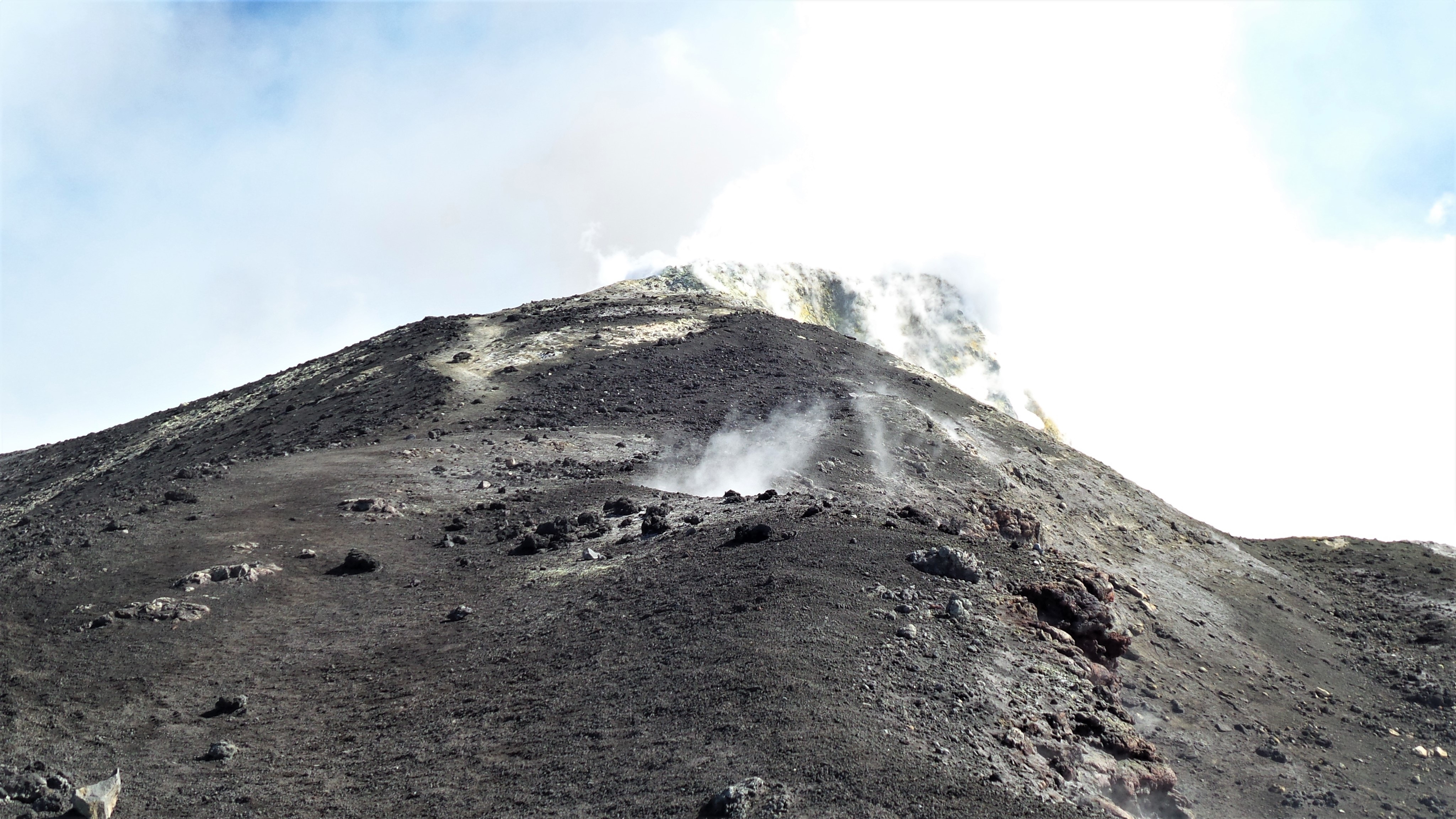
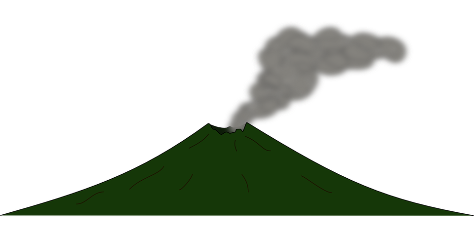
A geologist is studying a volcano that has a moderate slope—not too steep—and is made up of alternating layers of hardened lava, ash, and volcanic rocks from past eruptions. Based on these characteristics, what type of volcano is it most likely?
Cinder
Composite
Shield
Dormant
While exploring a volcanic region, scientists come across a volcano with very steep sides. It was formed by explosive eruptions that threw out ash and cinders, creating a cone-shaped hill with a crater at the top. What type of volcano is this?
Cinder
Shield
Shade
Composite
Along the San Andreas region in California, there is a large crack in Earth’s crust where two blocks of rock slide past each other, occasionally causing earthquakes. What is this kind of crack called?______________.
sink hole
mountain
fault line
glacier
As a river flows into a larger body of water, such as an ocean or a lake, it slows down and drops the sediment it was carrying. Over time, this forms a fan-shaped deposit at the river’s mouth. What is this landform called?
delta
hill
earthquake
sand dune
The Himalayan Mountains in India are some of the tallest mountains in the world. They formed over millions of years as huge pieces of Earth’s crust pushed against each other, causing the land to crumple and rise. What type of tectonic boundary is responsible for creating mountain ranges like the Himalayas?
Transform Boundaries
Geological Boundaries
Convergent Boundaries
Divergent Boundaries
While visiting a volcanic island, students notice a volcano with gentle, sloping sides that resemble an upside-down bowl. It was formed by lava that flowed easily and spread out over large areas. Based on its shape and how it formed, what type of volcano is this?
brown
cinder
composite
shield
A coastal town builds a long structure that extends into the ocean next to the beach. Over time, people notice that the beach near this structure keeps more of its sand, even during strong waves. What is this structure called and how does it help protect the beach?
Jetty – It helps prevent the waves from carrying away the sand
Geyser – It releases steam and water near the shore
Seismograph – It measures earthquake activity beneath the beach
Volcano – It adds new land to the beach with lava flows
To reduce soil erosion on a sloped farm, a farmer decides to plow along the natural curves of the hill rather than straight up and down. This method helps slow down water runoff and keeps the topsoil in place. What is this farming technique called?
control plowing
hill farming
contour plowing
crops
New Orleans, Louisiana, is a city that borders the Mississippi River, Lake Pontchartrain, and the Gulf of Mexico. The city sits below sea level and is subject to more and more flooding. New Orleans would be considered a
divergent boundary
water boundary
flood plain
danger zone
A type of farming where “steps” are built onto slopes of hills and mountains in order to keep topsoil from eroding away w it rains. What type of farming is this called?
Step Farming
Slope Farming
Terrace Farming
Hill Farming
The picture shows the devastation after an earthquake. What tool would scientists use to measure and record the magnitude of an earthquake?
equator
stethoscope
timer
seismograph/Richter Scale
What is the geological process by which natural forces such as wind, water, or ice move soil particles, including sand, silt, and sediment, from one location to another?
Weathering
Erosion
Landform
Deposition
The table shows the greatest flood height a river reached over a period of 40 years. Which change was most likely made to the river after year 20 that would explain the trend in flood height?
A storm drain was built to increase the amount of water running into the river during floods
A dam was most likely built to decrease the amount of water in the river during floods
The riverbank was made taller to increase the amount of water flowing onto land during floods.
The river channel was made straight to decrease the speed of the water running