Geography of India
star
star
star
star
star
Posljednje ažuriranje over 4 years ago
19
Complete the Assessment below.
Complete the Assessment below.

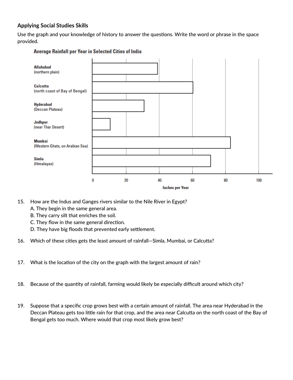
Which of these cities gets the least amount of rainfall- Simla, Mumbai, or Calcutta
What is the location of the city on the graph with the largest amount of rain
As the Brahmaputra river flows from the mountains into the valley, it becomes
Because of its large size and its pollution in relation to large masses of land water, India is called
On the map, find the northern tip of the Bay of Bengal. Why is the nearby soil so fertile?
Compared with the Eastern and Western Ghats, the Deccan Plateau has
Farmers in the Deccan Plateau use the iron-rich black soil principally to raise
During the summer in India, the monsoon brings
Which phrase best describes the Eastern and Western Ghats
Which of the following parts of India has the most fertile farmland
Much of the water in the Indus, Ganges, and Brahmaputra rivers comes from
How has the location of the Himalaya Mountains benefited India
Travelers went throguh the Khyber Pass to cross the
The lower Indus River (the part nearer the sea) flows through what is now the country of
A traveler in the Thar Desert would be likely to see many
Where were the earliest known settlements in India
How are the Indus and Ganges Rivers similar to the Nile in Egypt
Because of the quantity of rainfall, farming would likely be especially difficult around which city?
Suppose a specific crop grows best with a certain amount of rainfall. The area near Hyderpad in the Deccan Plateau gets too little rain for that crop, and the area near Calcutta on the north coast of the Bay of Bengal gets too much. Where would that crop most likely grow best?