Monsoon Asia Mapping Challenge 1
star
star
star
star
star
Posljednje ažuriranje almost 3 years ago
15
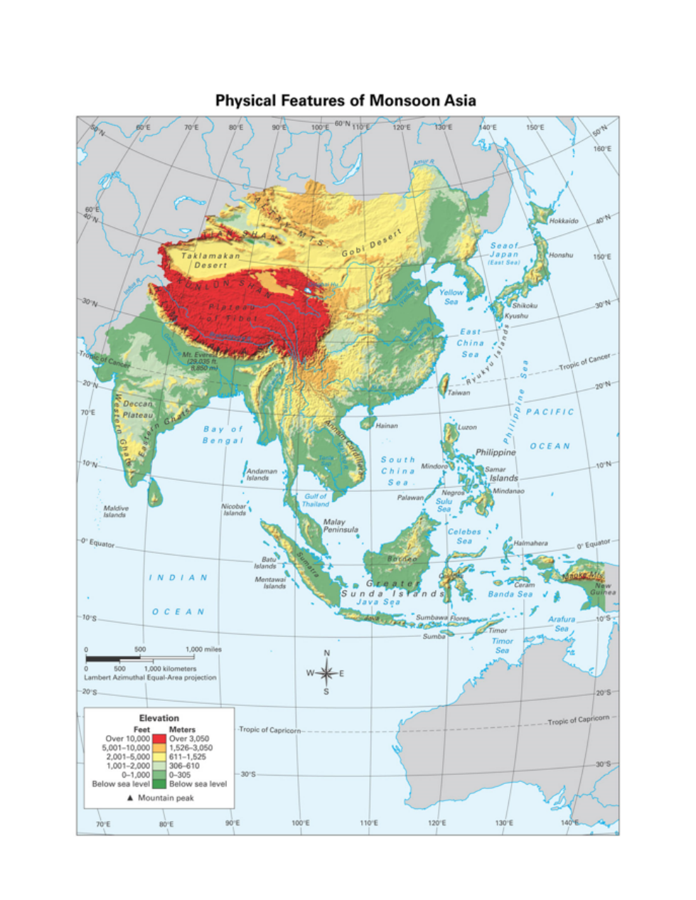
The feature located at
(15°N, 90°E):
The feature located at
(18°N, 78°E):
The feature located at
(27°N, 80°E):
The feature located at
(42°N, 110°E):
The feature located at
(30°N, 82°E):
The feature located at
(35°N, 115°E):
The feature located at
(8°S, 110°E):
The feature located at
(5°N, 102°E):
The feature located at
(15°N, 106°E):
The feature located at
(28°N, 87°E):
The feature located at
(20°N, 130°E):
The feature located at
33°N, 90°E):
The feature located at
(40°N, 135°E):
The feature located at
(40°N, 84°E):
The feature located at
(32°N, 120°E):