Latin America Mapping Challenge 1
star
star
star
star
star
Posljednje ažuriranje over 1 year ago
15
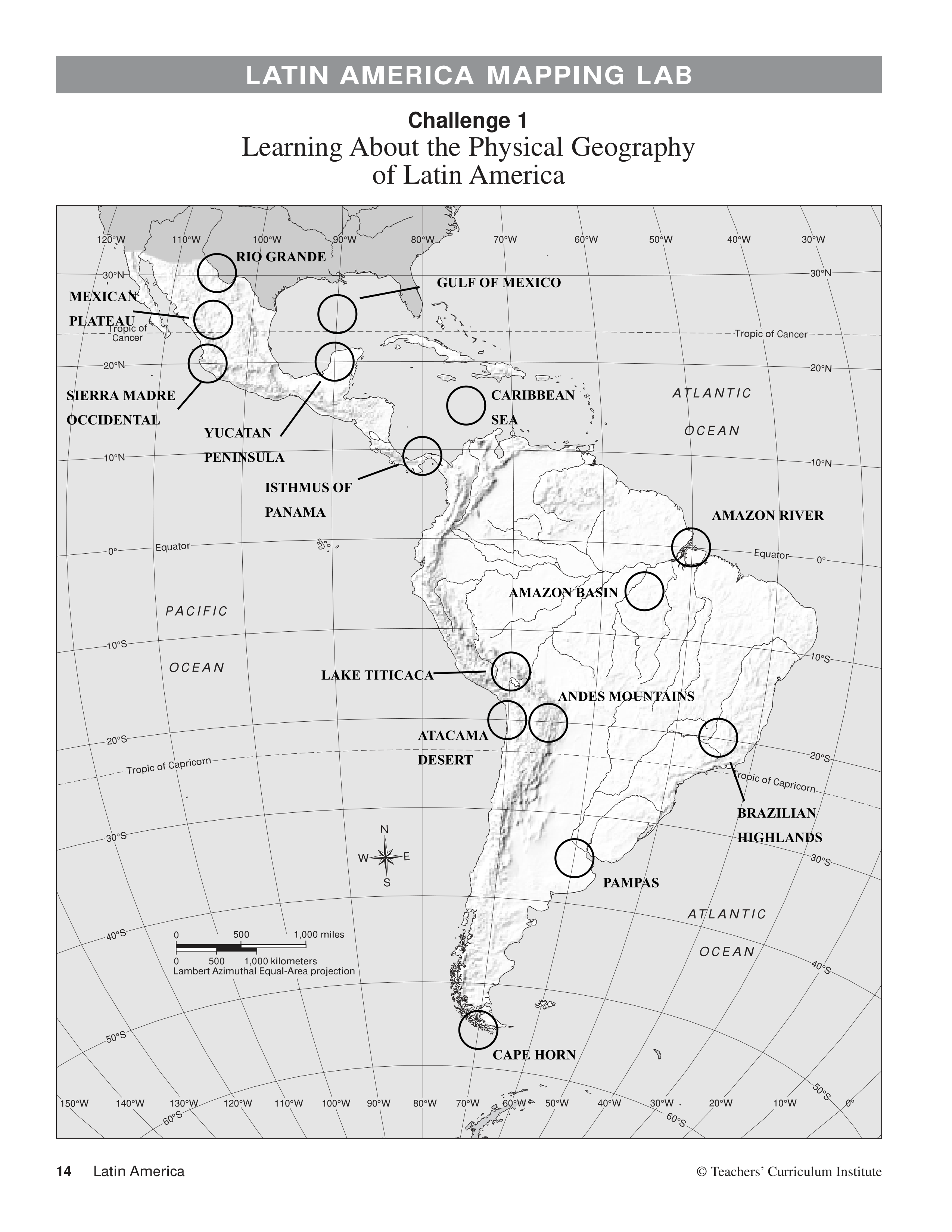
The feature located at
(20°S, 65°W):
The feature located at
(25°N, 105°W):
The feature located at
(20°S, 45°W):
The feature located at
(20°N, 90°W):
The feature located at
(55°S, 70°W):
The feature located at
(35°S, 60°W):
The feature located at
(20°N, 105°W):
The feature located at
(8°N, 80°W):
The feature located at
(5°S, 55°W):
The feature located at
(15°N, 75°W):
The feature located at
(0°, 50°W):
The feature located at
(20°S, 70°W):
The feature located at
(15°S, 70°W):
The feaure located at
(30°N, 105°W):
The feature located at
(25°N, 90°W):