Obavezno
1
Obavezno
1
Obavezno
1
Obavezno
1
Obavezno
1
Obavezno
1
0
Obavezno
1
Obavezno
1
Obavezno
1
Obavezno
1
Obavezno
1
Obavezno
1
Label as many of the 50 states as you can within the time given. (Example = NY, or NJ). Draw arrows/label to the side if needed.
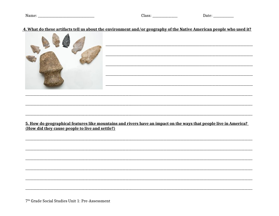
4. What do these artifacts tell us about the environment and/or geography of the Native American people who use
5. How do geographical features like mountains and rivers have an impact on the ways that people live in America? (How did they cause people to live and settle?)
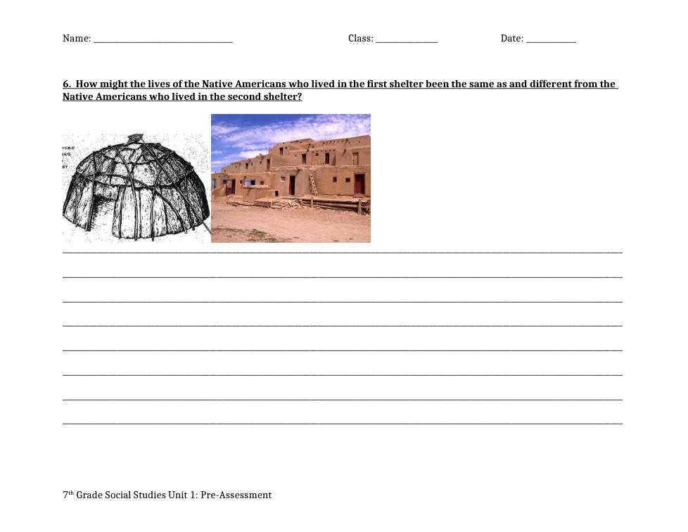
6. How might the lives of the Native Americans who lived in the first shelter been the same as and different from the Native Americans who lived in the second shelter?
a. In what Continent is the United States of America located:
b. In which hemisphere(s) can the United States of America be found:
c. Which country borders the United States of America on the south?
d. Which country borders the United States of America on the North?
e. Which body of water borders the United States of America to the East?
f. Which body of water borders the United States of America to the West?
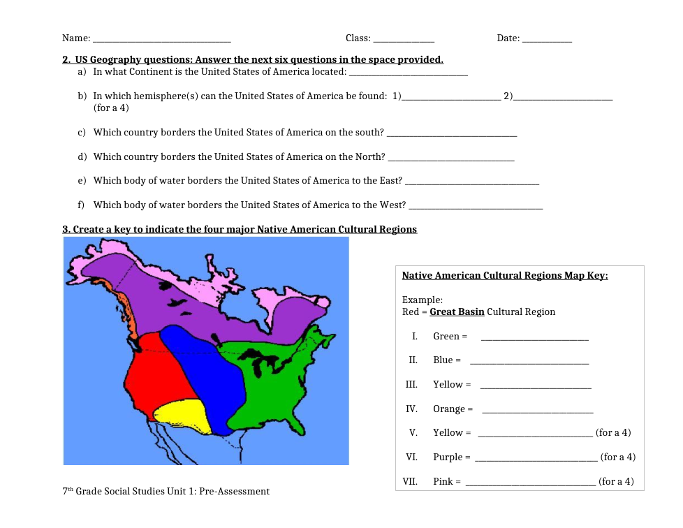
3. Create a key to indicate the four major Native American Cultural Regions.
Example:
Red = Great Basin Cultural Region
I. Green
II. Blue
III. Yellow
IV. Orange
VI. Purple
VII. Pink