Air Pressure
We experience pressure from the air all around us. Air is made up of many molecules, mainly nitrogen and oxygen. These molecules are constantly bumping into us from all different directions. The force from these molecules bumping against us is what creates air pressure.
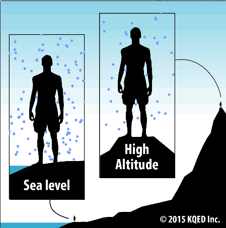
We don’t tend to notice air pressure because it remains relatively constant when we stay at the same elevation. However, air pressure decreases as we move from sea level to the top of a mountain. There are fewer air molecules bumping against you the higher up you go, so the air pressure is lower. You may have felt the effects of this pressure change when flying in an airplane or driving to the top of a mountain. The pressure change causes your ears to “pop.”
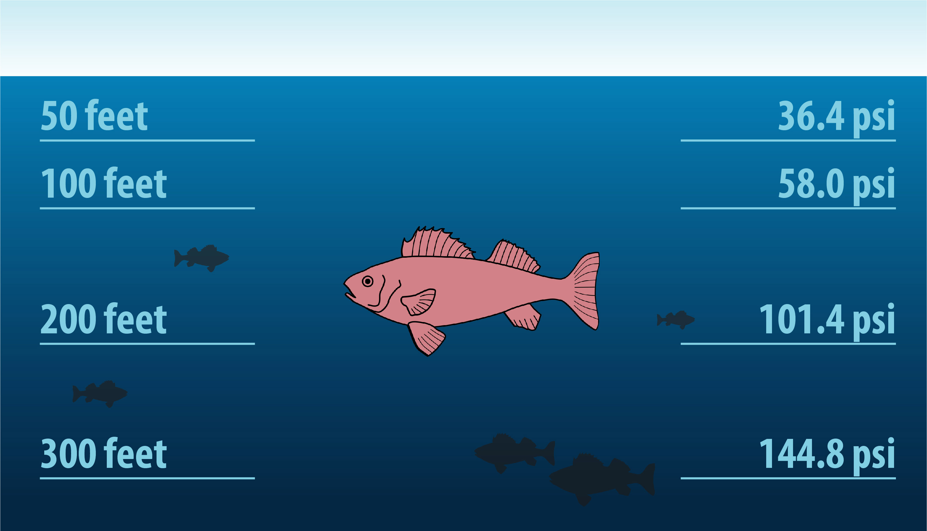
When you’re submerged in the ocean, you experience pressure from the force of the water molecules that surround you. At the surface, the pressure from the water is the same as the pressure from the air. Pressure increases the deeper you go in the ocean because there is more water above you. This water has weight, and weight is force. This force pushes against you, so you experience greater pressure all around.
Pressure is measured in many different units. Air pressure at Earth’s surface is equal to one atmosphere (atm).