Write the approximate location of Cairo, Egypt

latitude andlongitude.
Write the approximate location of Cairo, Egypt
latitude andlongitude.
A compass rose is used on a map to indicate direction.
Write the approximate location of Cairo, Egypt
latitude andlongitude.
What continent is connected to South America by Panama ?
If you wanted to find the distance on a map between two places, what measurement tool would you use on map?
What is the prime meridian?
What body of water is located at 0°latitude, 0°longitude?

What city is located near 35°S latitude, 35°E longitude?

In what country do the lines of 10 S and 20 E longitude cross?
In what country do the lines of 25 N , 0 degrees longitude cross?
In what country do the lines of 25 N, 20 E longitude cross?
Write the nearest whole-degree coordinates for Kenya
Distance north and south of the Equator is measured in degrees of
What is the name for the lines that run north to south on a map?
Name 2 countries that are on the equator

Name one country that is on the Prime meridian

If you were in Oklahoma , in which direction would you have to travel to reach Kansas ? Use intermediate directions when necessary.

If you were in Oklahoma, in which direction would you have to travel to reach New Mexico ? Use intermediate directions when necessary

If you were in Oklahoma, in which direction would you have to travel to reach Florida? Use intermediate directins when necessary to
If you were in Oklahoma, in which direction would you have to travel to reach Washington? Use intermediate directions when necessary
If you were in Oklahoma, in which direction would you have to travel to reach Rhode Island Use intermediate directions when necessary
What covers most of the Amazon River basin?

What are the two nearest trains to Pace High School ? ( has to be the closest )
In New York we get our water through which of geographical feature?
Which geographical feature/ body of water is represented in the image above
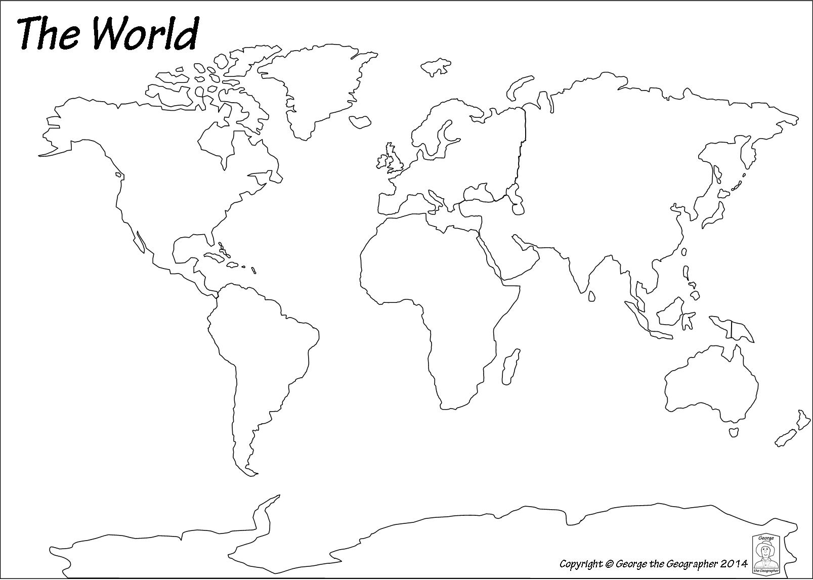
Africa is a ...
Daylight time savings is usually connected which geographical vocabulary ...
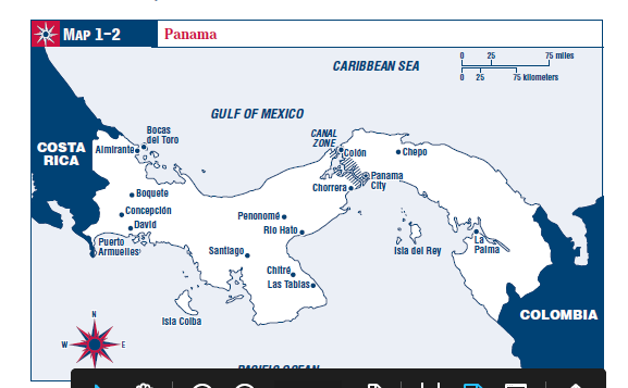
Use map on the left... The country of Colombia is located to the west of Panama
Use map on the left... The Carribbean Sea is located to the north of Panama
Use map on the left... When a ship enters the Panama Canal at Colon, it is northwest of the other end of the canal at Panama City
