Ɛhia
1
1
Ɛhia
1
Ɛhia
1
Ɛhia
1
In the medieval period, Europe was a diverse and dynamic continent with various kingdoms, empires, and societies. A map of medieval Europe reveals a complex landscape of power struggles, cultural exchange, and shifting borders. One prominent feature on a map of medieval Europe is the Holy Roman Empire, a vast realm encompassing modern-day Germany, Austria, Switzerland, and parts of Italy and France. The medieval period also saw the rise of powerful kingdoms such as France, England, and Spain, each vying for dominance over the continent. Trade routes crisscrossed medieval Europe, connecting distant regions and facilitating the exchange of goods, ideas, and technologies. Major cities like Paris, Venice, and Constantinople emerged as centers of commerce, culture, and learning. Additionally, the map of medieval Europe highlights the influence of the Catholic Church, which played a central role in shaping society and politics during this time. Monasteries, cathedrals, and pilgrimage sites dotted the landscape, serving as important religious and cultural centers. Overall, a map of medieval Europe provides valuable insights into the complexities and interconnectedness of societies in the Middle Ages.
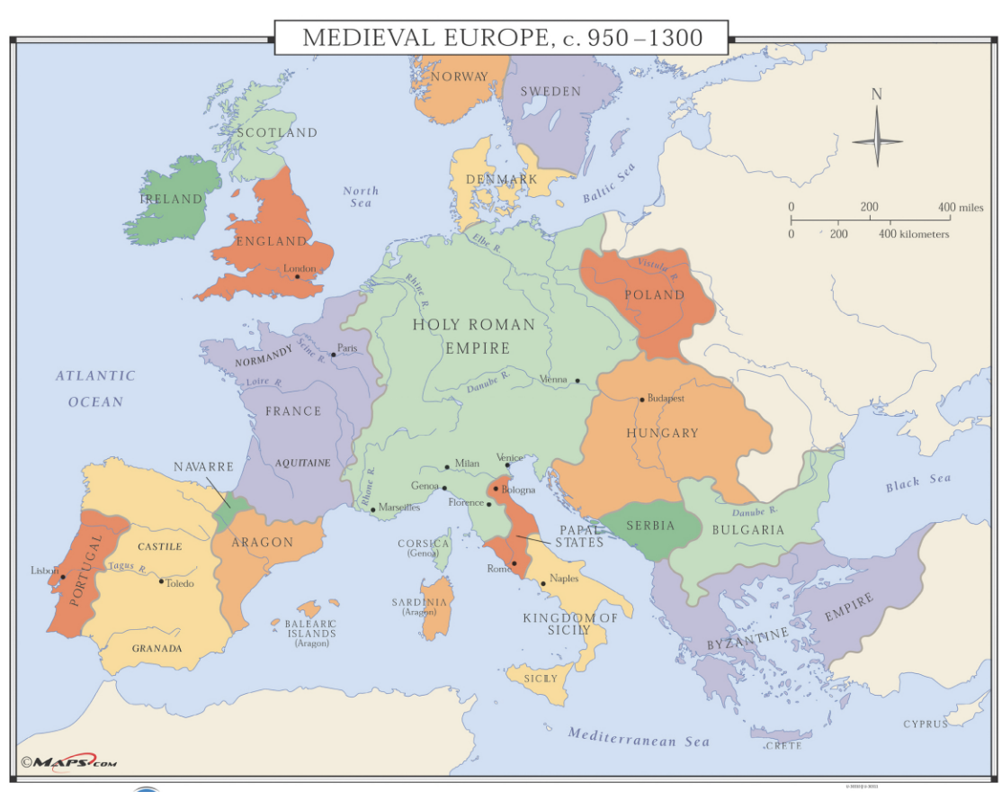
Which sea borders Medieval Europe to the south?
Identify the Atlantic Ocean
Identify England
Identify the Holy Roman Empire.
Identify Scotland.
Identify Ireland.
Identify France.
Identify the African continent.
Identify the Mediterranean Sea.
Identify the Kingdom of Sicily.
Identify the Black Sea.
Identify the Byzantine Empire.
Identify the North Sea.
Why were medieval castles primarily built with thick stone walls and narrow slit windows?
What was the purpose of the Great Hall in a medieval castle?
How did the lack of hygiene affect life inside a medieval castle?
What was the primary purpose of medieval castle construction?
Why were medieval castles symbols of authority and control?

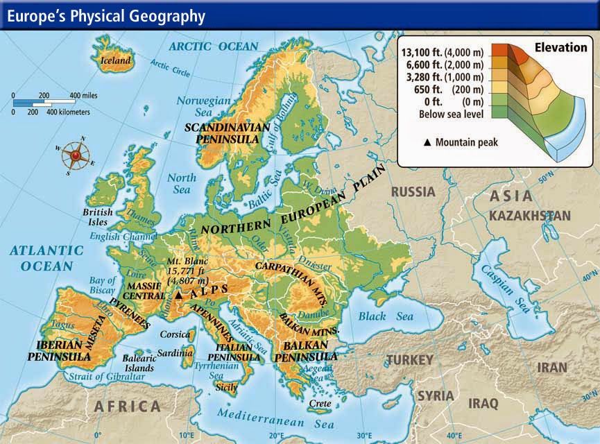
Which mountain range separates the Iberian Peninsula from Europe?
What bodies of water (there are 2) lie east of the Balkan Peninsula?
What natural barrier separates Italy from the rest of Europe?
Which mountain range separates Europe from Asia? Do a Google search.
Which sea lies between Italy and the Balkan Peninsula?
Which region was not part of the Holy Roman Empire?
What was a common feature of major medieval cities?
Which kingdom was not mentioned as powerful in medieval Europe?
What institution had significant influence in medieval Europe?
Where did the Byzantine Empire exist in Medieval Europe?