Twa kɔ nsɛm atitiriw so
Log in
Sign up for FREE
arrow_back
Laabri

Industrialization, Migration, and Immigration Maps

star
star
star
star
star
Last updated over 1 year ago
9 Nsɛmmisa
Hyɛ no nsow a efi ɔkyerɛwfo no hɔ:

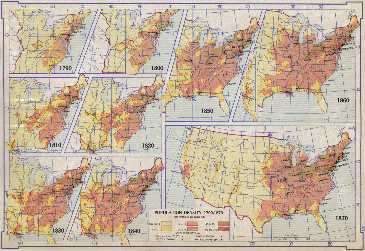
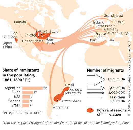
Map exercises to investigate the link between industrialization, migration, immigration, and urbanization.

1
Asemmisa {{asɛmmisaAhyɛnsode}}
1.

List three specific industries shown on these maps. What symbols are used to represent them on the map?

1
1
Asemmisa {{asɛmmisaAhyɛnsode}}
2.

Describe two patterns of industry distribution that you can see on these maps.

1
Asemmisa {{asɛmmisaAhyɛnsode}}
3.

What trends do you see on these maps moving between 1790 and 1870?

1
Asemmisa {{asɛmmisaAhyɛnsode}}
4.

What cities existed in 1870 that didn't in 1790?

1
Asemmisa {{asɛmmisaAhyɛnsode}}
5.

What trend do you see in these maps?

1
Asemmisa {{asɛmmisaAhyɛnsode}}
6.

How do you think this trend relates to the trend in the previous map?

1
Asemmisa {{asɛmmisaAhyɛnsode}}
7.

Where are immigrants moving from during this time period? (Where are their home countires?)

1
Asemmisa {{asɛmmisaAhyɛnsode}}
8.

Describe where (the poles and regions) where immigrants are settling in the Americas.

Asemmisa {{asɛmmisaAhyɛnsode}}
9.

Consider all of the maps together. How do they relate to each other?