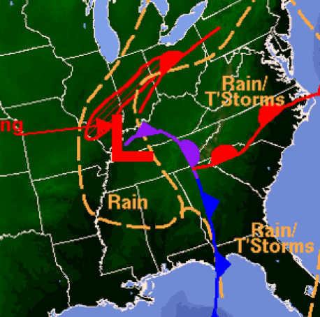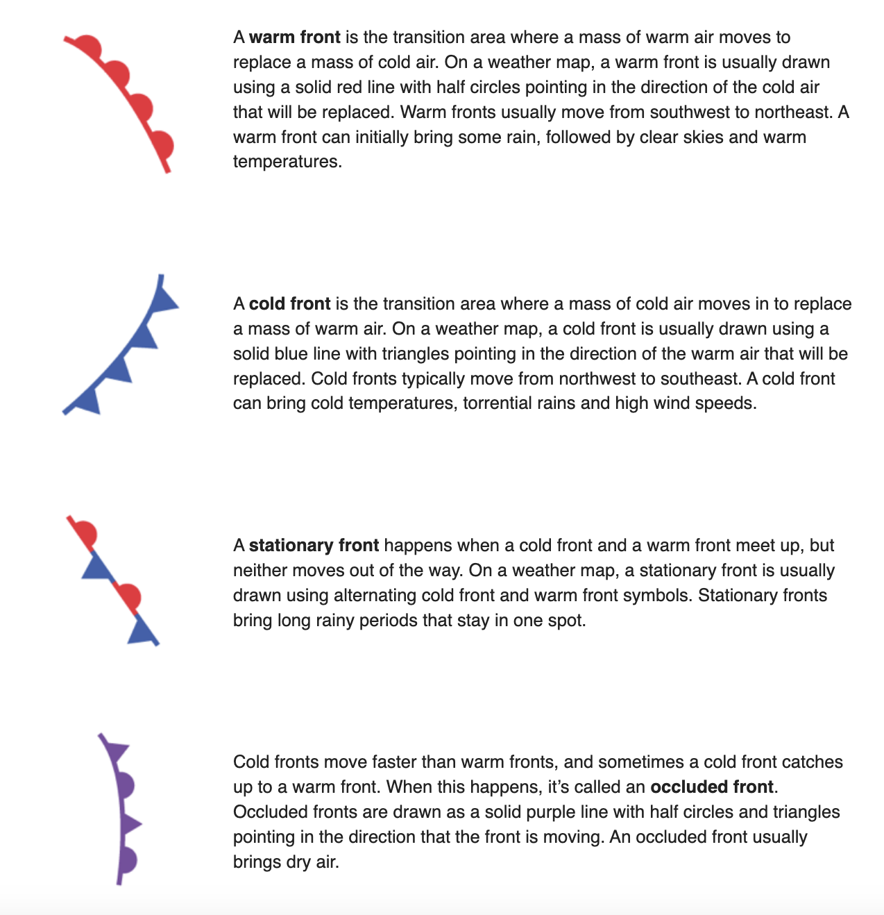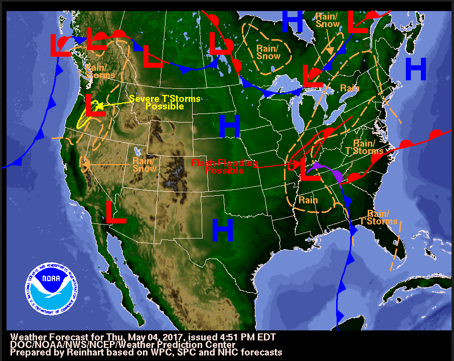
Meteorologists (scientists who study weather) at the National Weather Service use information from ground stations and weather satellites to make these maps. Words like “rain” and “snow” are pretty obvious, but what exactly do the symbols on a weather map tell you about the weather?
1
Pitanje 1
1.
What is a meteorologist?
What is a meteorologist?