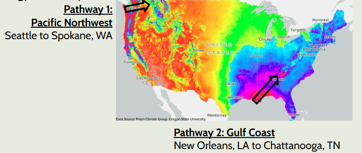
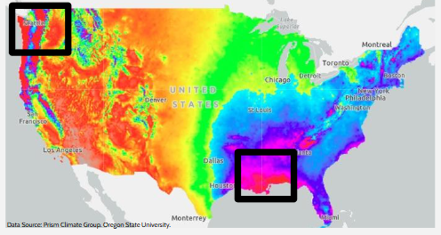
We will look at these two pathways and compare data along the pathway to try and make sense of the precipitation patterns.
Prediction: Why is there less precipitation further inland in the Pacific Northwest than further inland from the Gulf Coast?
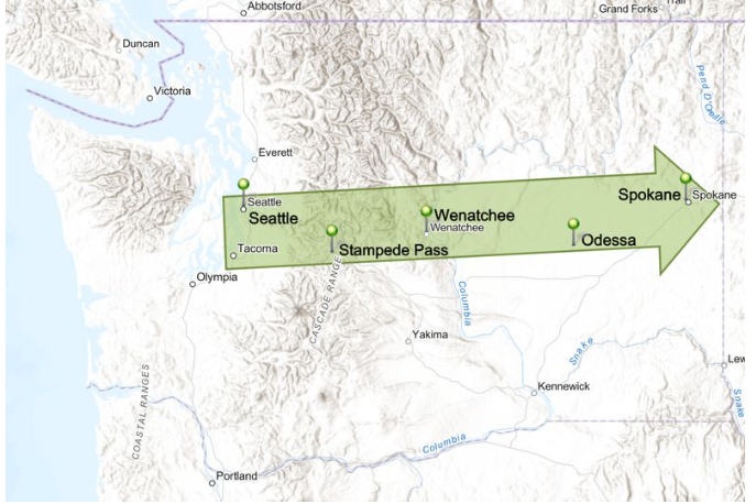
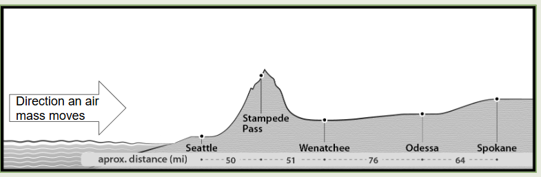
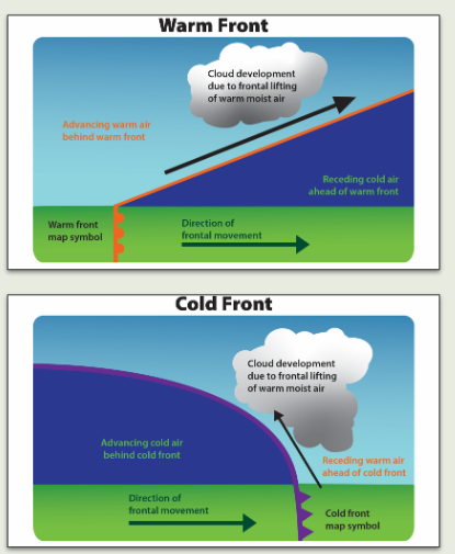
What do you notice about the cross section of the Pacific Northwest Pathway?
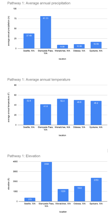
What patterns do you see in the Pacific Northwest data?
Where does most of the precipitation fall in this pathway?
Why do you think most of the precipitation is falling at Stampede Pass and very little is falling further inland?
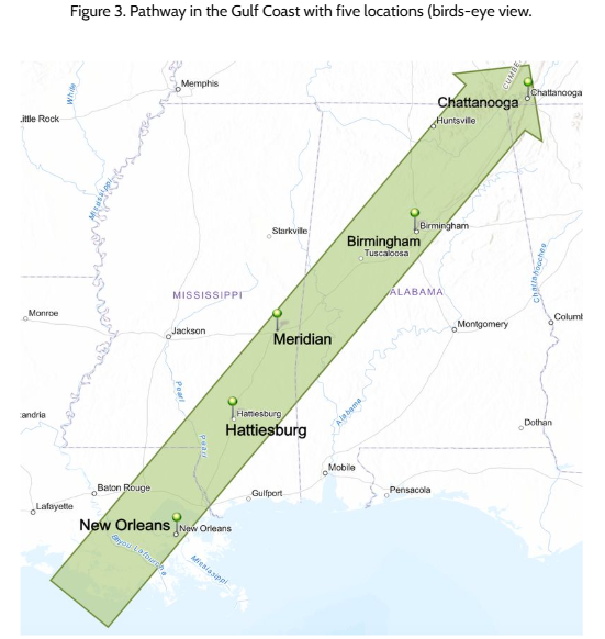
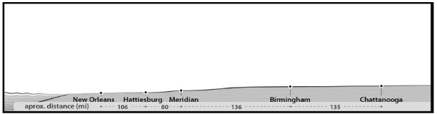
What do you notice about the cross section of the Gulf Coast pathway? What is different from the Pacific Northwest Pathway?
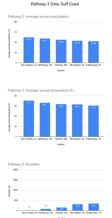
What patterns do you see in the Gulf Coast data?
How can we use this model to explain precipitation patterns in the Pacific Northwest and the Gulf Coast?
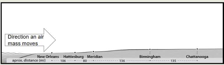
Explain why there is still a lot of precipitation in Birmingham and Chattanooga.
Answer the question as to why Wenatchee does not get as much precipitation as Seattle. Use your model to help you explain and make sure to include your vocab.
Humidity, Temperature, Air Mass, Evaporation, Condensation, and Precipitation, and Density