A teacher set up the model shown to represent the formation of a landform.
What landform does this model most likely represent?

Drugi mogući odgovor:
Sand dune
Cave
Canyon
Delta
A teacher set up the model shown to represent the formation of a landform.
What landform does this model most likely represent?
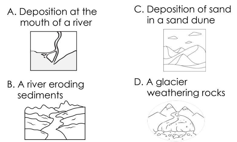
Which of the following processes is NOT considered a rapid change to Earth’s surface?
A -
B -
C -
D -
A canyon with tall, vertical sides is shown.
Which of the following most likely led to the formation of this canyon?
The table shows how wind, water, and ice change Earth’s surface.
Which landform was most likely formed by the slow movement of glaciers?
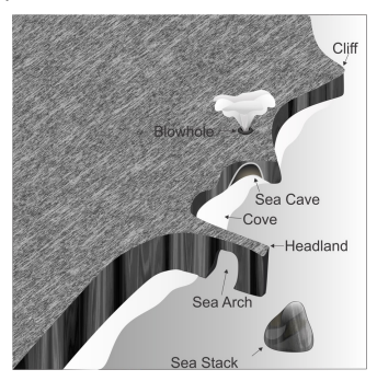
What agent of change is most likely responsible for the formation of the land features labeled in the image?
The process in which rock is broken down into smaller pieces is called
When water enters the cracks in a large rock and freezes, the water expands. Over time, water freezing and thawing –
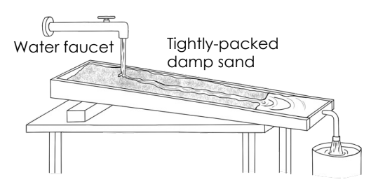
A teacher built the model shown to explain how one type of landform is created.
What landform does the model most likely represent?
The images show a river delta and sand dunes.
Which statement best explains how the formation of deltas and sand dunes is similar?
Which pair of landforms are the result of the same agent of change?
The characteristics of a valley are described.
This valley was most likely formed by –
Which student-created model best represents the formation of a delta?
A wide, round-bottom valley is shown below.
This valley was most likely
formed by –
Which of the following describes deposition due to water?
While on a field trip, students observed sand dunes and wrote the following list of observations.
This sand dune was most likely formed by –
A diagram of a delta is shown.
Which process best describes the formation of this delta?
While on a field trip, students observed a canyon and wrote the following list of observations.
This canyon was most likely formed by –
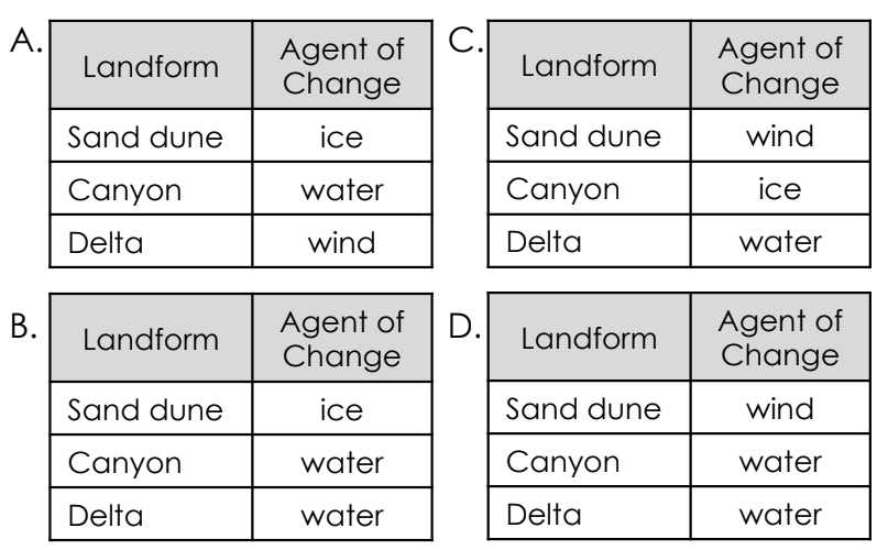
Which table correctly identifies the agents of change for the corresponding landforms?
Which image best shows the movement of sediments from one place to another?
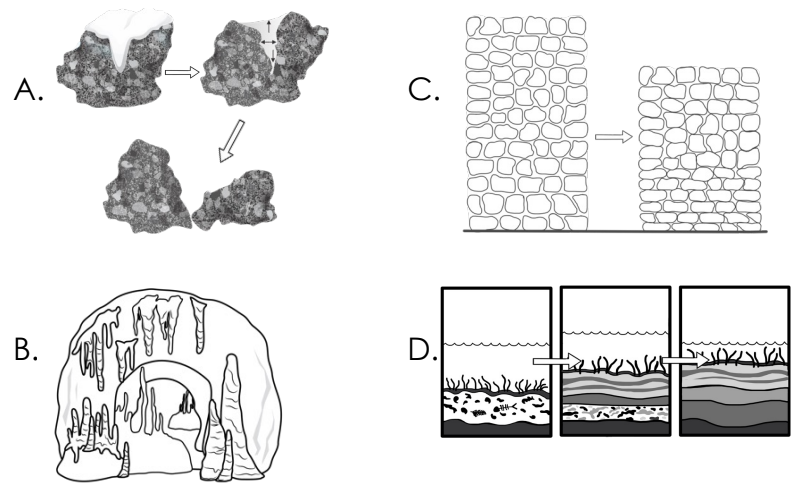
Which diagram best represents the process of frost wedging?