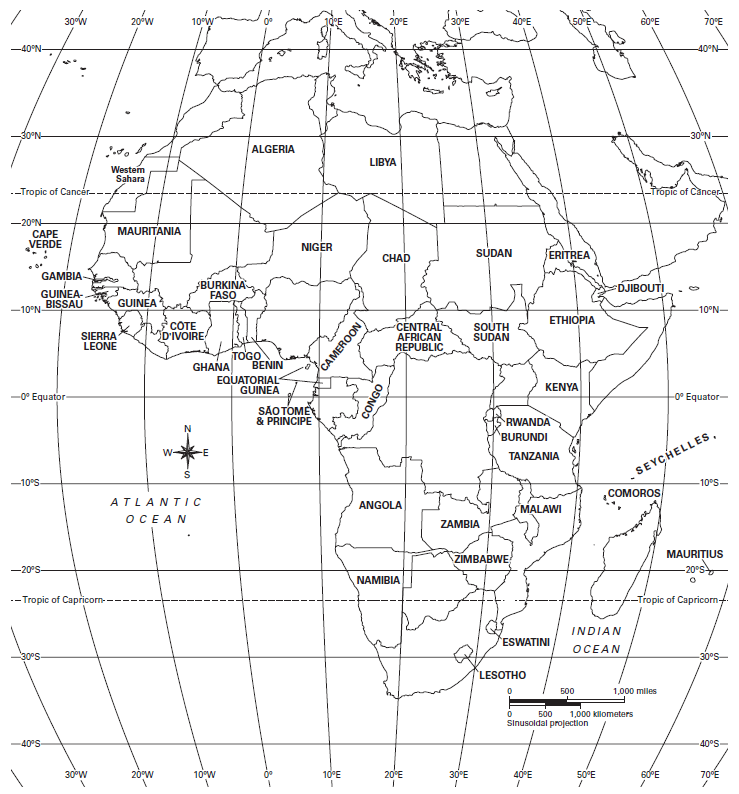
Drag and drop each terrain feature to the correct location using the grid coordinates provided.
Drag and drop each country to the correct location using the grid coordinates provided.
If doing this from home, use the following links:
Which 6 African countries north of the equator have petroleum (oil) as a resource?
In which three countries can a humid subtropical climate be found?
Identify the four most highly populated cities in Africa. Drag each of these four cities into the country in which it is located. (Only four of the cities will be used)
Algiers
Johannesburg
Nairobi
Cairo
Dakar
Lagos
Kinshasa
Abidjan
Egypt
Nigeria
Dem. Rep. of the Congo
South Africa
Besides South Africa, in which five countries can trade and manufacturing be found?
What river forms the border between Senegal and Mauritania? (Use correct spelling and capitalization)
Use the maps to drag each description to the correct location. Each category should have 5 characteristics.
Climate: arid
Economics: forestry, commercial farming, trade, and manufacturing nearby, coal nearby
Physical: mountainous, near the Orange River (elevation 5,001-10,000ft)
Climate: semiarid and tropical wet and dry
Physical: near the Nile River, level land (elevation 0-1,000ft)
Population: over 250 people per square mile-closest city Cairo
Climate: marine west coast
Physical: in the Sahel, near the Niger River (elevation 0-2,000ft)
Population: 25-125 people per square mile-closest city Durban
Vegetation: broadleaf evergreen forest
Population: 25-125 people per square mile-closest city Bamako
Vegetation: highlands
Vegetation: tropical grassland
Economics: commercial farming, nomadic herding nearby, petroleum, natural gas, and iron nearby
Economics: subsistence farming, commercial farming nearby, no natural resources
13°N, 6°W
30°S, 29°E
28°N, 31°E

This picture was most likely taken at...