Permafrost
Key Points
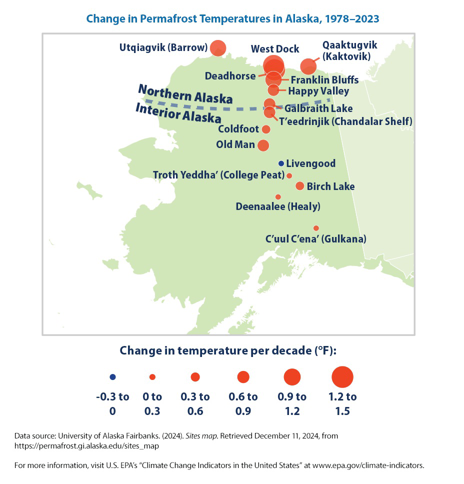
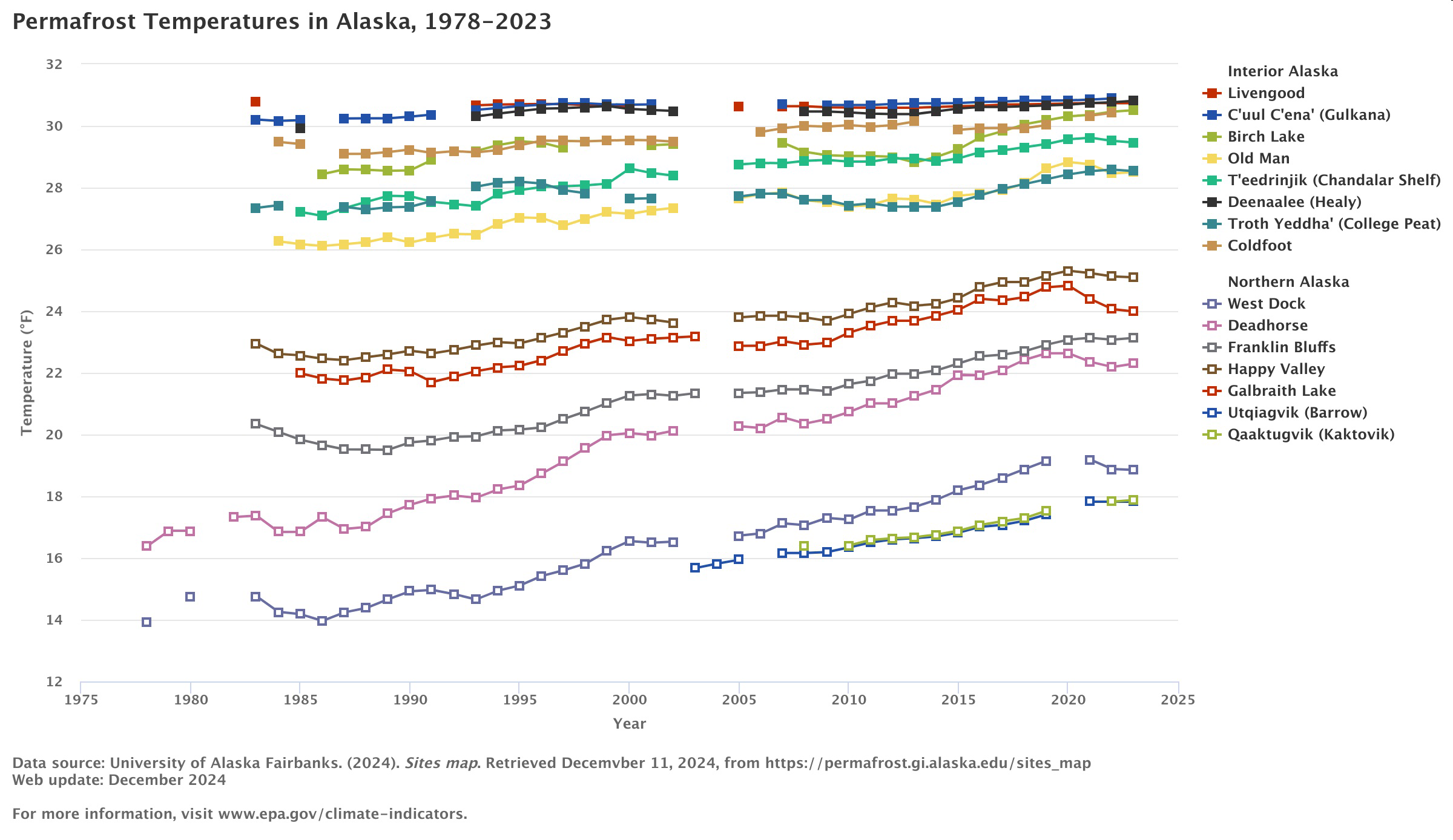
Between 1978 and 2023, permafrost temperatures increased at 14 of the 15 borehole sites shown in this indicator (see Figures 1 and 2). Warming was statistically significant at all 14 of the boreholes that had increases.
In general, permafrost has warmed more quickly in northern Alaska than interior Alaska (see Figure 2). The increasing rate of change in the north is consistent with changes in air temperatures, which have increased more quickly in northern Alaska than in other parts of the state.
The Deadhorse site in northern Alaska had the highest rate of temperature change, at
Changes in permafrost temperature shown in this indicator are consistent with changes observed in Russia, Canada, and other parts of the Arctic.
Background
Permafrost is defined as rock or soil that remains at or below the freezing point of
A thawing permafrost layer can lead to severe impacts on people and the environment. For instance, as ice-filled permafrost thaws, it can turn into a muddy slurry that cannot support the weight of the soil and vegetation above it. Infrastructure such as roads, buildings, and pipes could be damaged as permafrost thaws. Infrastructure damage and erosion, due in part to permafrost thaw, has already caused some communities in western and southern Alaska to have to relocate. Additionally, organic matter (like the remains of plants) currently frozen in the permafrost will start to decompose when the ground thaws, resulting in the emission of methane and carbon dioxide into the atmosphere. This contributes to further global climate change.
Graph of Information - Figure 1.
This figure shows permafrost temperature at borehole sites in interior and northern Alaska, measured at the end of summer (approximately September of each year). Measurements at these sites were taken at depths between 49 and 85 feet.
Graph of Information - Figure 2.
This map shows the change in permafrost temperature per decade for long-term borehole sites in Alaska. Larger circles correspond to greater rates of warming per decade. The blue circle represents a cooling trend. Borehole measurement depths range from 49 to 85 feet.