Read the excerpt and analyze the documents.
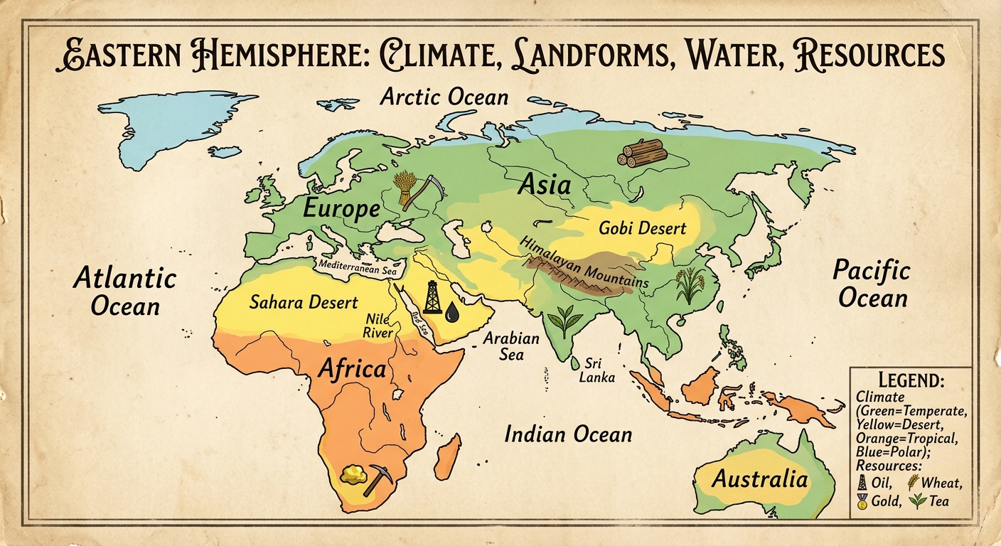
Climate and landforms shape where people farm, trade, and settle. Rivers and resources connect regions, but also create competition.
Figure 1.
Use the historical document(s) and the short readings in the left panel to answer the associated questions.
Use the historical document(s) and the short readings in the left panel to answer the associated questions.
Read the excerpt and analyze the documents.
Climate and landforms shape where people farm, trade, and settle. Rivers and resources connect regions, but also create competition.
Figure 1.
Which piece of evidence from the poster map best supports the idea that landforms can limit travel and connection between regions?
A student argues: “The map proves resources always lead to conflict.” Which response most accurately evaluates that claim using evidence?
Which claim is best supported by evidence from the excerpt and the poster map?
Using two specific pieces of evidence from the poster map (for example, a labeled landform/body of water, a climate zone, or a resource icon), explain how geography could shape economic activity in one Eastern Hemisphere region.
Use evidence from the excerpt and the poster map to explain one way geography can create cooperation or competition between regions. Cite at least one excerpt phrase and one map feature.
Study the posters. Use its labels, icons, and legend to identify Eastern Hemisphere regions and support conclusions with evidence.
Figure 1.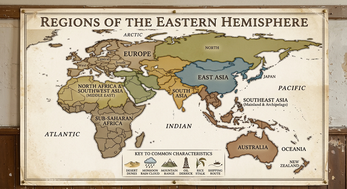
Figure 2.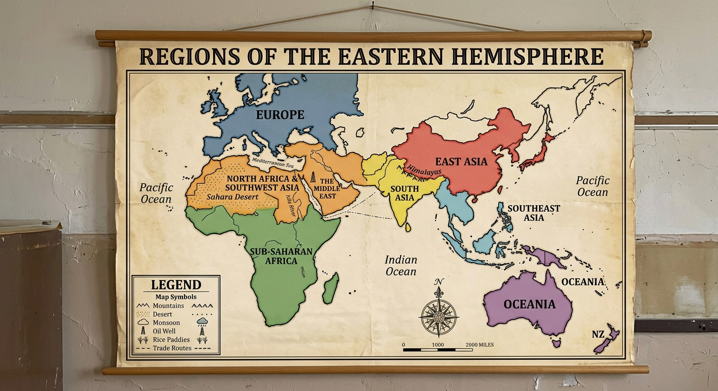
Which region is best supported by the evidence of a monsoon icon and rice symbol grouped together on the poster?
Which pair of regions is best supported by poster evidence as sharing a major desert climate characteristic?
Which evidence from the poster best supports the idea that regions are based on shared characteristics, not only political borders?
Choose one region shown on the poster. Cite two specific poster details (a label and an icon) and explain how they show a shared characteristic of that region.
Evaluate the claim: “Regions in the Eastern Hemisphere are defined only by political borders.” Use two pieces of evidence from the poster to support your evaluation.
Study the poster and its legend. Use its evidence to explain how physical environments influence settlement, land use, and economic connections across regions.
Figure 1.
Figure 2.
Figure 3.
A student claims: “Deserts usually support the same land use as monsoon regions.” Which response best evaluates this claim using poster evidence?
Which poster evidence best supports the conclusion that rivers often attract dense settlement and farming?
Which claim is best supported by the poster’s combination of mountains, climate zones, and trade-route symbols?
Explain one way the physical environment could influence population distribution and political connections in the Eastern Hemisphere. Cite two pieces of poster evidence.
Use two specific poster details (a physical feature and a land-use/economic icon) to explain how environment influences economic activity in one region.
Study the cartoon. Use its labels and symbols to explain how present-day regional issues can have roots in the past.
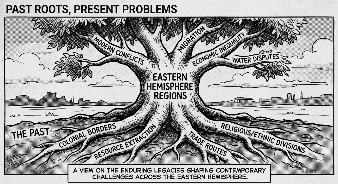
A student claims: “The cartoon argues that all modern issues have only one historical cause.” Which response best evaluates this claim using evidence?
Select one branch label (a present-day issue) from the cartoon. Cite one root label and explain how the past factor could contribute to that issue.
Which inference is best supported by the cartoon’s pairing of “resource extraction” roots with a branch labeled “economic inequality”?
Explain how the cartoon uses at least two pieces of evidence (labels or symbols) to show that regional problems are often multi-causal. Cite the evidence you use.
Which detail from the cartoon is the clearest evidence for the idea that current problems can be connected to past decisions?