Use the historical document(s) and the short readings in the left panel to answer the associated questions.
Maps can show climate zones, landforms, bodies of water, and resources. Compare the two regions on this document. Use the legend to identify deserts, monsoon areas, mountains, seas, and resource icons. Then explain how each region’s geography helps you interpret settlement and trade.
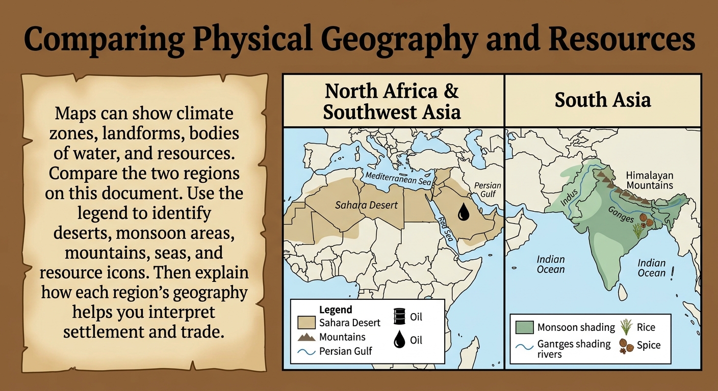
Which inference about economic activity is best contextualized by the map’s combination of climate zones, waterways, and resource icons?
Which comparison is best supported by the map’s climate and landform evidence?
Compare the two regions using two specific pieces of map evidence (one from each region). Explain how the differences could lead to different settlement patterns or economic activities. Be sure to cite the map features you use.
Use two map features to contextualize why certain historical trade routes developed in these regions. Explain how climate zones, landforms, or bodies of water could encourage or limit movement and exchange.
Which map evidence best supports the idea that bodies of water can connect regions through travel and trade?
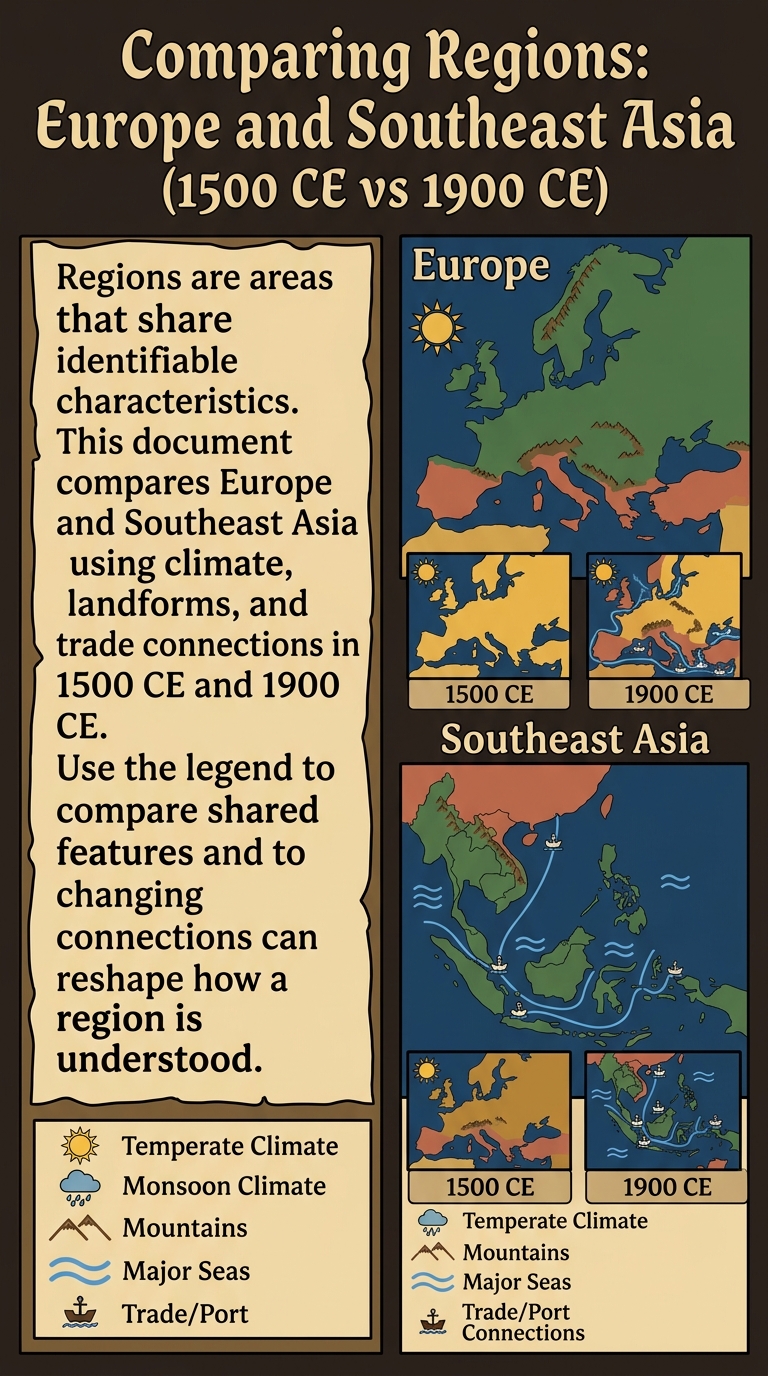
Regions are areas that share identifiable characteristics. This document compares Europe and Southeast Asia using climate, landforms, and trade connections in 1500 CE and 1900 CE. Use the legend to compare shared features and to explain how changing connections can reshape how a region is understood.

Which statement best contextualizes the change from 1500 CE to 1900 CE shown by the trade/port symbols?
Which poster detail is the clearest evidence that regions are defined by shared characteristics, not only political borders?
Which comparison is best supported by the climate and landform symbols on the poster?
Compare Europe and Southeast Asia using two specific pieces of poster evidence (one from each region). Explain how those features support defining regions by shared characteristics.
Choose one region (Europe or Southeast Asia). Use evidence from the 1500 CE and 1900 CE insets to contextualize how changing connections could affect the region’s economic or cultural characteristics. Cite at least two poster features.
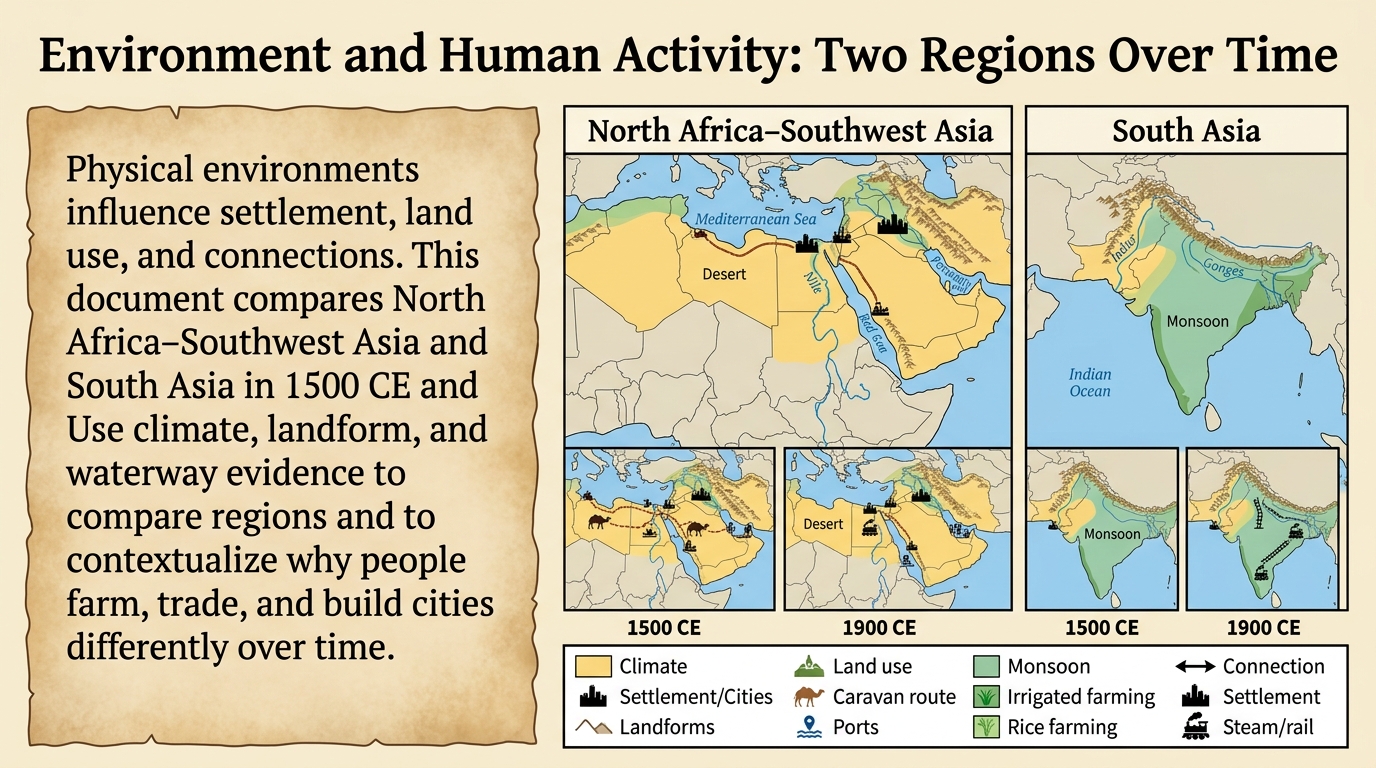
Physical environments influence settlement, land use, and connections. This document compares North Africa–Southwest Asia and South Asia in 1500 CE and 1900 CE. Use climate, landform, and waterway evidence to compare regions and to contextualize why people farm, trade, and build cities differently over time.

Which comparison is best supported by the poster’s climate and waterway evidence?
Compare the two regions using two specific pieces of evidence (one from each region) from the 1500 CE insets. Explain how the differences could lead to different settlement patterns or economic activities.
Which statement best contextualizes the change from 1500 CE to 1900 CE shown by the connection symbols (ports/steam/rail)?
Choose one region. Use evidence from both the 1500 CE and 1900 CE insets to contextualize how the physical environment influences economic connections over time. Cite at least two poster features.
Which inference about land use is best contextualized by the poster’s desert/river evidence for North Africa–Southwest Asia?
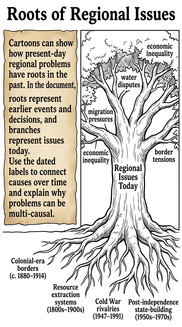
Regional issues often have roots in the past, but causes can differ by region and time period. This cartoon compares two regions by linking earlier decisions to present-day problems. Use the dated root labels to contextualize each issue and to compare how different past factors shape outcomes.

Which detail from the cartoon is the clearest evidence that present-day regional problems can be connected to past decisions?
Which statement best compares what the two trees suggest about why different regions can face similar present-day problems?
Which inference is best supported by comparing the root labels for Region A and Region B?
Choose one branch issue that appears on both trees. Compare the two regions by citing one root label from each tree and explaining how each root could contribute to the same present-day issue. Use evidence from the cartoon.
Contextualize one region’s present-day issues by explaining how the dates on two of its roots suggest a sequence of cause and effect over time. Cite the two roots you use and describe what changes from the earlier period to the later one.